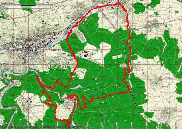
Von Niefern auf dem Enztal Radweg nach Mäuerach hinauf bis Buckenberg. Auf dem Schützenpfad ins Würmtal. Auf dem Gegenhang hinauf nach Huchenfeld und weiter nach Würm wieder hinab ins Tal. Über die Würm hinauf zum Hagenschieß und gerade zur Spieleiche bis zur Autobahn. Unter der Autobahn hindurch und durchs Kirnbachtal zurück nach Niefern.
Further information at
http://www.biketreff-niefern.deGalerie du tour
Carte du tour et altitude
Minimum height 237 m
Maximum height 477 m
Commentaires

Start in Niefern an der Enz Apotheke.
Mehr Infos unter http://www.biketreff-niefern.de
Mehr Infos unter http://www.biketreff-niefern.de
Tracks GPS
Trackpoints-
GPX / Garmin Map Source (gpx) download
-
TCX / Garmin Training Center® (tcx) download
-
CRS / Garmin Training Center® (crs) download
-
Google Earth (kml) download
-
G7ToWin (g7t) download
-
TTQV (trk) download
-
Overlay (ovl) download
-
Fugawi (txt) download
-
Kompass (DAV) Track (tk) download
-
Feuille de tours (pdf) download
-
Original file of the author (g7t) download
Add to my favorites
Remove from my favorites
Edit tags
Open track
My score
Rate


