


Fahrradtour Cinque Terre
Startpunkt: Parkplatz neben dem Militärhafen von La Spezia an der Straße nach Portovenere
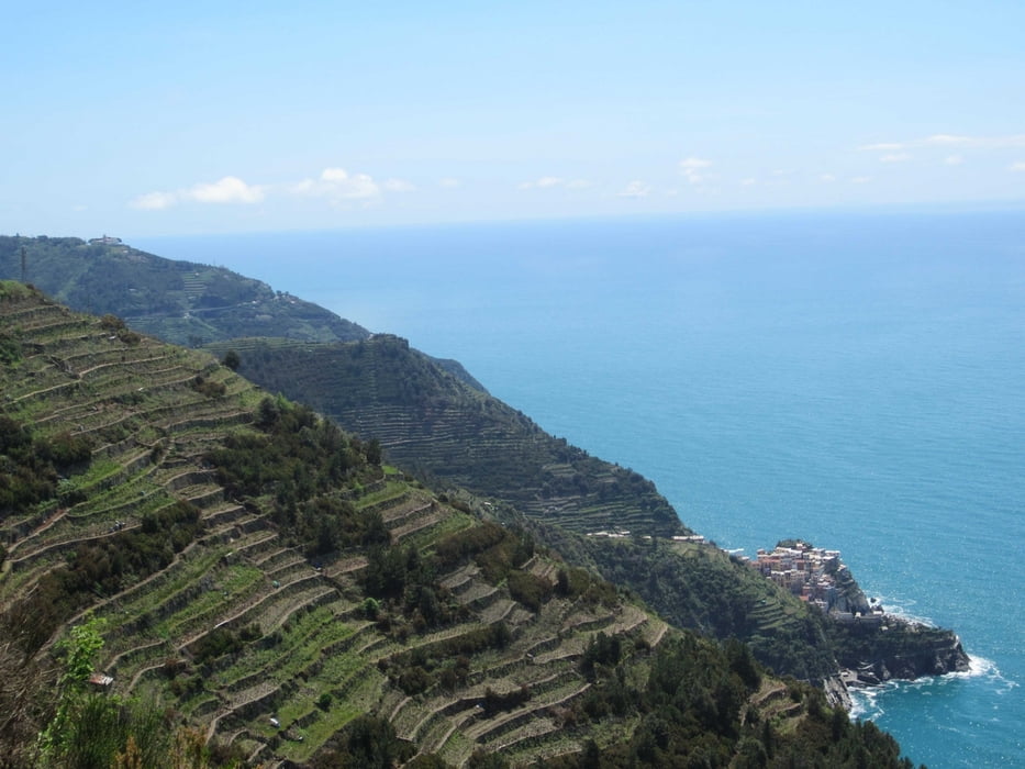
Der Nationalpark Cinque Terre (5 Erden) ist eine wunderbare Steilküste an der Riviera und bezeichnet die 5 Orte Monterosso, Vernazza, Corniglia, Manarola und Riomaggiore. Diese waren lange Zeit nur mit dem Schiff vom Meer aus erreichbar. Heute erreicht man diese einmalig sehenswerten Orte auch mit der Bahn oder über eine Küstenstraße mit unvergleichlichen Panoramablicken.
Die Tour verläuft im Wesentlichen auf dieser Küstenstraße Nr. 370 und führt hinunter zu den einzelnen Orten mit Ausnahme von Monte Rosso, da die Straße wegen eines Erdrutsches im Oktober 2011 an einer Stelle nicht passierbar war. In der Kompasskarte 644 ist die Route eingetragen. Wegen eines Tunnels empfiehlt sich ein Licht mitzunehmen.
Galerie du tour


Carte du tour et altitude
Minimum height -34 m
Maximum height 520 m
More about the tour author
|
|
RudolfTill |
Commentaires

Vom Autobahnkreuz der A 12 und A 15 nach La Spezia fahren.
Tracks GPS
Trackpoints-
GPX / Garmin Map Source (gpx) download
-
TCX / Garmin Training Center® (tcx) download
-
CRS / Garmin Training Center® (crs) download
-
Google Earth (kml) download
-
G7ToWin (g7t) download
-
TTQV (trk) download
-
Overlay (ovl) download
-
Fugawi (txt) download
-
Kompass (DAV) Track (tk) download
-
Feuille de tours (pdf) download
-
Original file of the author (gpx) download
More about the tour author
|
|
RudolfTill |
Add to my favorites
Remove from my favorites
Edit tags
Open track
My score
Rate