


Diese Tour ist nur eine kleine Tour:
Bad Boll www.bad-boll.de ist der Startpunkt und durchaus sehenswert. Dann geht es hoch zum Albtraufgängerweg www.albtraufgaenger.de. Die Wege sind in der Regel Forstwege. Ein paar Wanderwege sind dabei.
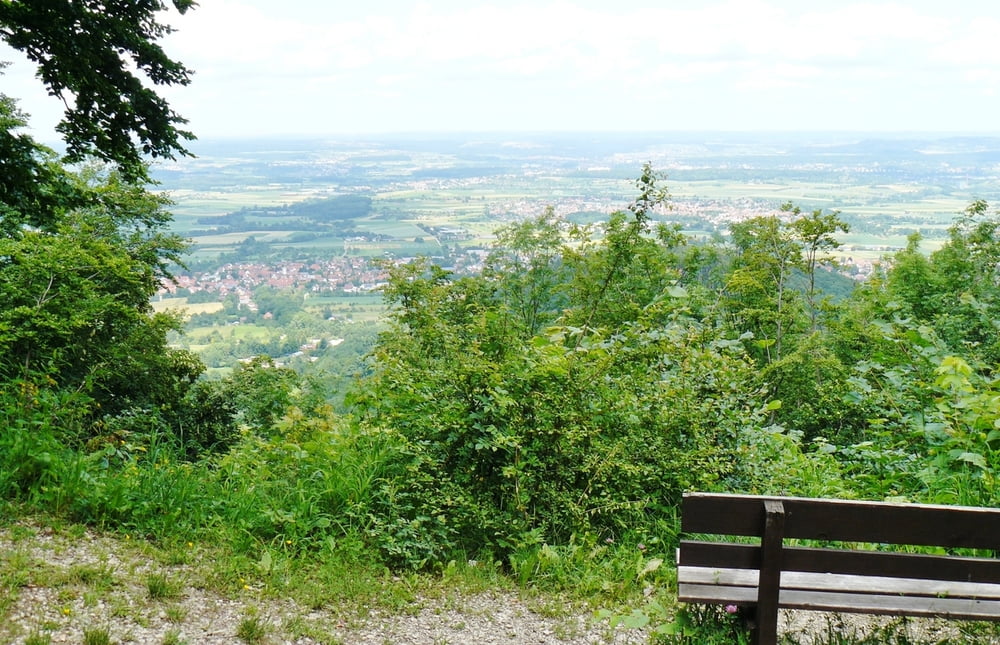
Allerdings der Aufstieg zur Bertaburg ist anders: Hier muss in der Regel geschoben werden. Und dann kommt die Enttäuschung: Es gibt keine Bertaburg mehr. Nur eine Information und eine Schutzhütte ist vorhanden. Entschädigt wird man aber auf der Strecke durch die schönen Ausblicke vom Albtrauf herab. Die Aussichten sind wirklich schön.
Zum Schluss geht es dann doch (leider) über die Straße zurück nach Gammelshausen, und dann sind es auch nur noch zwei Kilometer zurück nach Bad Boll.
Weitere Bilder zur Strecke: www.panoramio.com/photo/74256165
Further information at
http://www.schwaebischealb.deGalerie du tour


Carte du tour et altitude
Minimum height 310 m
Maximum height 741 m
More about the tour author
|
|
MatthiasBy |
Commentaires

In der Nähe der www.ev-akademie-boll.de sind Parkplätze zu finden.
Es lohnt sich auch noch die Touren www.gps-tour.info/de/touren/detail.16455.html oder www.gps-tour.info/de/touren/detail.18598.html oder www.gps-tour.info/de/touren/detail.36203.html anzuschauen.
Tracks GPS
Trackpoints-
GPX / Garmin Map Source (gpx) download
-
TCX / Garmin Training Center® (tcx) download
-
CRS / Garmin Training Center® (crs) download
-
Google Earth (kml) download
-
G7ToWin (g7t) download
-
TTQV (trk) download
-
Overlay (ovl) download
-
Fugawi (txt) download
-
Kompass (DAV) Track (tk) download
-
Feuille de tours (pdf) download
-
Original file of the author (gpx) download
More about the tour author
|
|
MatthiasBy |
Add to my favorites
Remove from my favorites
Edit tags
Open track
My score
Rate