

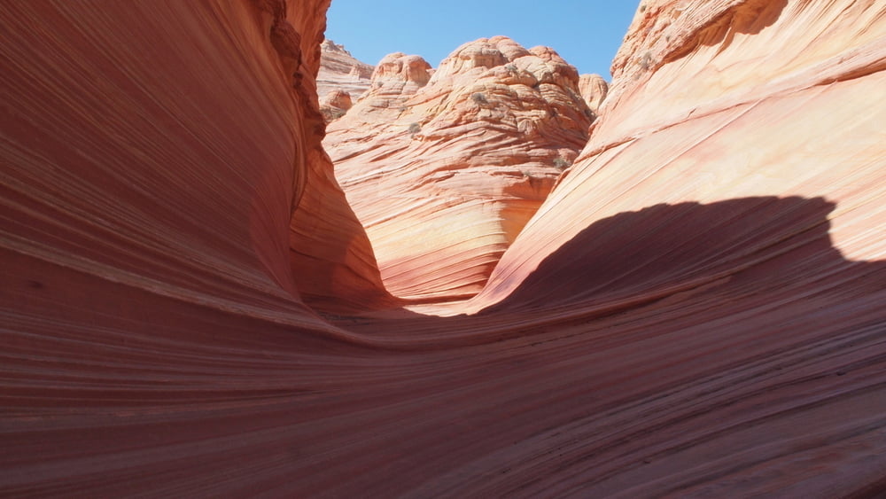
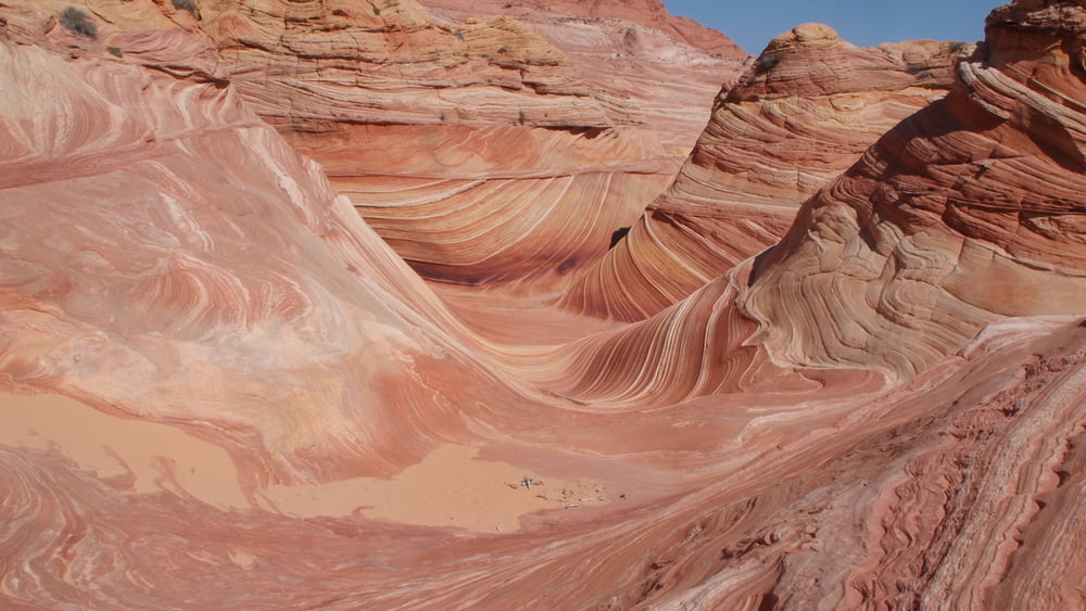
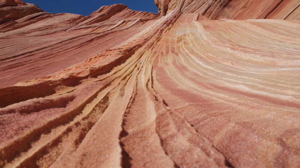
You've certainly seen pictures of the Wave. It's gorgeous.
A hiking permit is a must. If it was open for all tourists, the delicate stone would be worn away within a couple of years. Every nature photographer wants to shoot "The Wave".
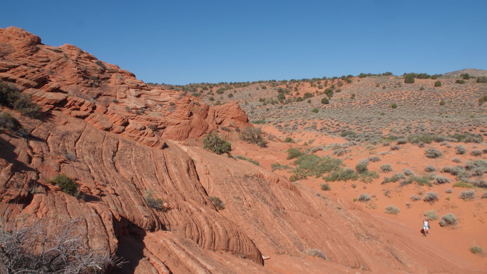
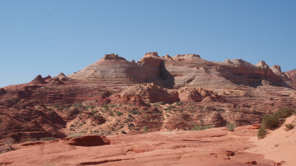
The Wave is located on the Colorado Plateau, near the Utah and Arizona border.
Whenever you consider a guided day or multi-day tour Think of Dreamland Safari Tours located in Kanab. It's one of the best. Website : http://www.dreamlandtours.net/
Galerie du tour


Carte du tour et altitude
Minimum height 1436 m
Maximum height 1621 m
More about the tour author

|
willydn |
Commentaires

Wire Pass Trailhead
From Kanab, drive 40 miles east on Highway 89. The turn onto House Rock Road is located on the right side of the road. It is located between mile markers 25 and 26.
Continue House Rock Road 8.3 miles to the Wire Pass Trailhead parking lot, located on the right side of the road. Display your parking permit in your windshield.
The Wave Route
At wire pass, walk across the House Rock Valley road, to the east, and locate the hikers path.
Soon the path drops into a wash. Walk down the wash (east) for .6 miles.
Hiking becomes steep for the next few hundred yards.
Most important landmark to locate the Wave : Vertical Crack or Notch.
Once you have a permit, you will get an excellent guide how to go to "The Wave".
This guide is given by Grand Staircase-Escalante National Monument Visitor Center in Kanab, 745 E. Highway 89, Utah.
Tracks GPS
Trackpoints-
GPX / Garmin Map Source (gpx) download
-
TCX / Garmin Training Center® (tcx) download
-
CRS / Garmin Training Center® (crs) download
-
Google Earth (kml) download
-
G7ToWin (g7t) download
-
TTQV (trk) download
-
Overlay (ovl) download
-
Fugawi (txt) download
-
Kompass (DAV) Track (tk) download
-
Feuille de tours (pdf) download
-
Original file of the author (gpx) download
More about the tour author
|
|
willydn |
Add to my favorites
Remove from my favorites
Edit tags
Open track
My score
Rate