Login

Login oublié ?

Cookies have to be accepted!
Your browser's cookie functionality is disabled. Please enable this functionality.

Not a member yet?

Register now
Login

Available for registred users only

Log in to use this feature.

Login oublié ?

Cookies have to be accepted!
Your browser's cookie functionality is disabled. Please enable this functionality.

Not a member yet?

Register now
Filter
Catégories
Advanced filters
  • Longueur (km)
  • Altimètre
Enregistrer le filtre Reset filter

TrackRank

QRCode

Technical data

Longueur7,5 km Altimètre785 m Way down30 m Durée01:15 h:m Date17.08.2012
Evaluations Author Paysage Aspect amusement Condition Technique

Statistiques

766 Vues Evaluations 39 Téléchargements Moyenne
Rate
  • Feuille de tours
  • Arrivée
  • Téléchargements
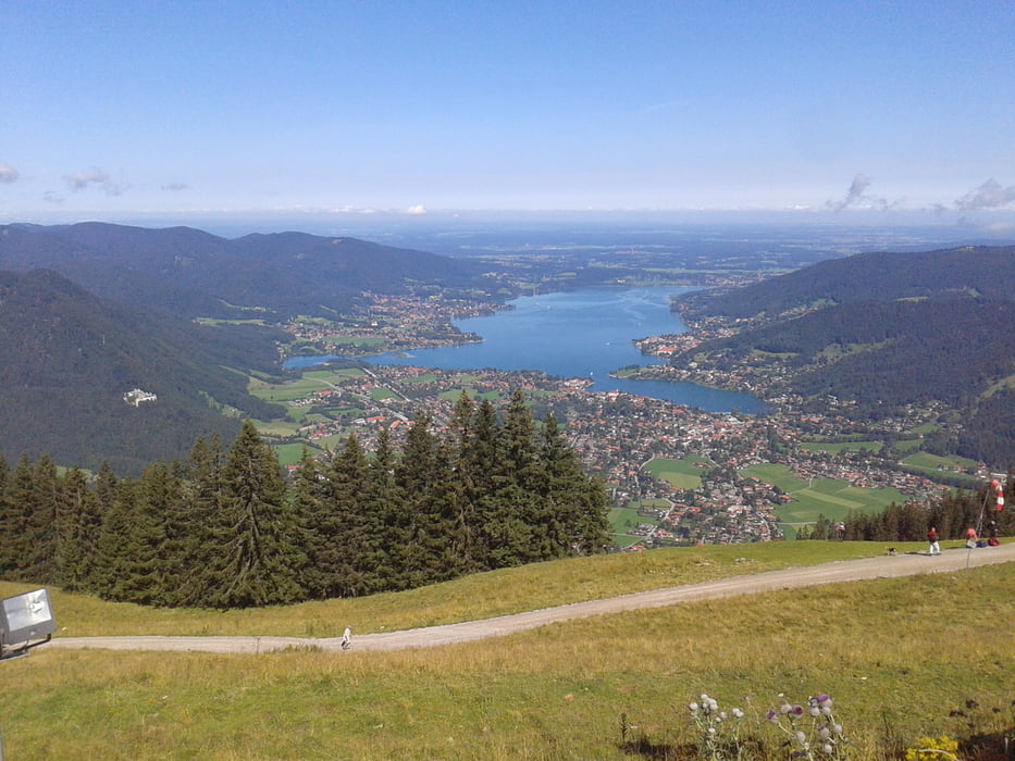
Kurze aber ordentlich steile Tour zum Wallberg hoch. Im Schnitt 100 Höhenmeter pro Km. Einfach zu fahren, da bis auf die letzten 100 Höhenmeter alles Asphalt.

Galerie du tour

Carte du tour et altitude

  • Open Street Map
  • Google
Minimum height 892 m Maximum height 1659 m Vue de détail

More about the tour author

zozoon
Member since 2012

Send private message

Commentaires

Tracks GPS

Trackpoints
  • GPX / Garmin Map Source (gpx) download
  • TCX / Garmin Training Center® (tcx) download
  • CRS / Garmin Training Center® (crs) download
  • Google Earth (kml) download
  • G7ToWin (g7t) download
  • TTQV (trk) download
  • Overlay (ovl) download
  • Fugawi (txt) download
  • Kompass (DAV) Track (tk) download
  • Feuille de tours (pdf) download
  • Original file of the author (gpx) download

More about the tour author

zozoon
Member since 2012

Send private message
Share track
Add to my favorites
Remove from my favorites
Edit tags
My score
Rate
Tour: Wallberg von Enterrottach über Asphaltstraße
Cat.: Mountainbike
Longueur: 7,5 km
Evaluated on:
Durée:
Day(s)
Hour(s)
Minute(s)
Evaluation: Paysage Aspect amusement Condition Technique