Login

Login oublié ?

Cookies have to be accepted!
Your browser's cookie functionality is disabled. Please enable this functionality.

Not a member yet?

Register now
Login

Available for registred users only

Log in to use this feature.

Login oublié ?

Cookies have to be accepted!
Your browser's cookie functionality is disabled. Please enable this functionality.

Not a member yet?

Register now
Filter
Catégories
Advanced filters
  • Longueur (km)
  • Altimètre
Enregistrer le filtre Reset filter

TrackRank

QRCode

Technical data

Longueur32,3 km Altimètre1747 m Way down1216 m Durée00:05 h:m Date20.08.2012
Evaluations Author Paysage Aspect amusement Condition Technique

Statistiques

540 Vues Evaluations 72 Téléchargements Moyenne
Rate
  • Feuille de tours
  • Arrivée
  • Téléchargements
Von Mörtschach übe Serpentinen zur Asten und weiter zue Glocknerblick Hütte. Super Aussicht und gutes Essen. Dann 1000 Höhenmeter Abfahrt zumeist über Asphaltierte Straßen. Zurück über Döllach zum Ausgangspunkt in Mörtschach
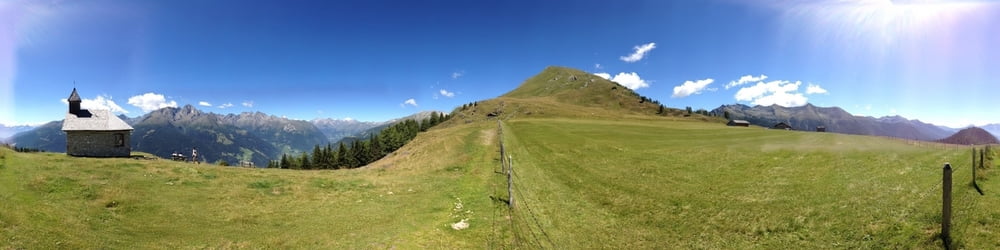
Galerie du tour

Carte du tour et altitude

  • Open Street Map
  • Google
Minimum height 426 m Maximum height 2081 m Vue de détail

More about the tour author

mosmax
Member since 2007

Send private message

Commentaires

Tracks GPS

Trackpoints
  • GPX / Garmin Map Source (gpx) download
  • TCX / Garmin Training Center® (tcx) download
  • CRS / Garmin Training Center® (crs) download
  • Google Earth (kml) download
  • G7ToWin (g7t) download
  • TTQV (trk) download
  • Overlay (ovl) download
  • Fugawi (txt) download
  • Kompass (DAV) Track (tk) download
  • Feuille de tours (pdf) download
  • Original file of the author (gpx) download

More about the tour author

mosmax
Member since 2007

Send private message
Share track
Add to my favorites
Remove from my favorites
Edit tags
My score
Rate
Tour: Glocknerblick Runde von Mörtschach
Cat.: Mountainbike
Longueur: 32,3 km
Evaluated on:
Durée:
Day(s)
Hour(s)
Minute(s)
Evaluation: Paysage Aspect amusement Condition Technique