


Tour über den Tremalzo
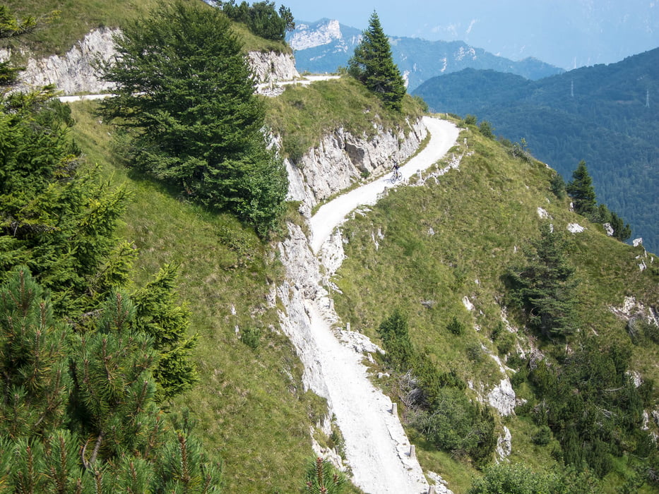
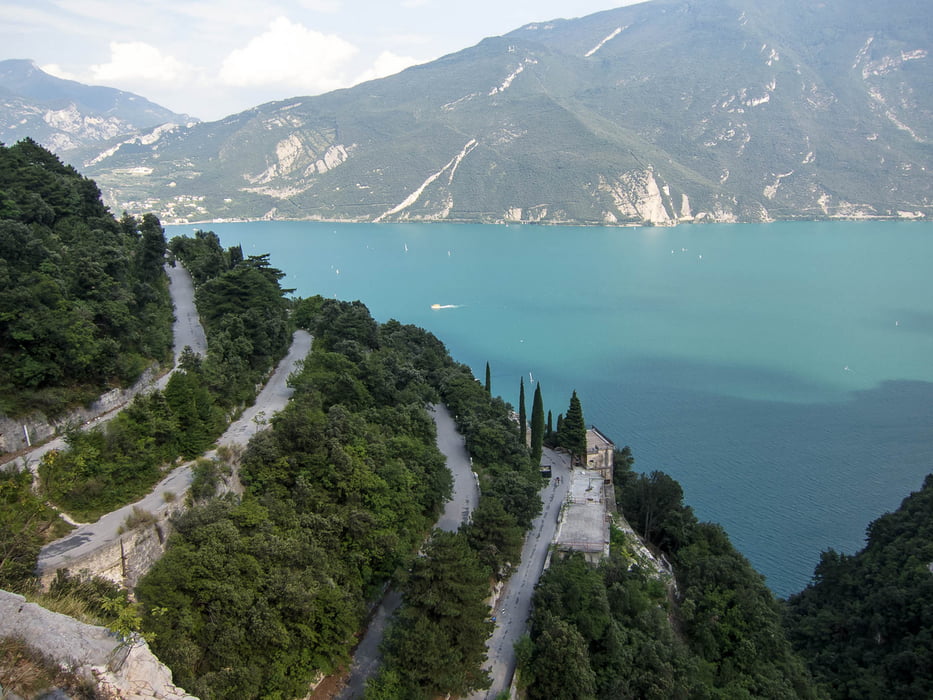
Von Riva geht es über die alte Ponale-Straße zum Ledrosee. Damit sind die ersten 600 Höhenmeter absolviert. Weiter geht es auf einem gut ausgebauten Radweg bis zum Abzweig zum Tremalzopass. Ab hier sind dann gut 1000 Höhenmeter am Stück zu bewältigen. Bis zum Riffugio Graffer alles auf Aspahlt und nicht zu steil. Nach dem Rifugio sind es dann nochmal 150 Höhenmeter bis zum Scheiteltunnel. Die können sich ziehen. Danach wartet die Abfahrt auf der alten Militärstraße. Wir haben am Passo Guil den Abzweig nach Pre ins Ledrotal gewählt. So war die gesamte Route fahrbar. Ansonsten kann man vom Passo Guil natürlich auch über Passo Rochetta und Malga Palaer nach Pregasina fahren. Da muss man aber auch mal schieben. Das letzte Stück ist dann wieder die alte Ponalestraße.
Galerie du tour


Carte du tour et altitude
Minimum height 58 m
Maximum height 1827 m
More about the tour author

|
mi_ec |
Commentaires

Tracks GPS
Trackpoints-
GPX / Garmin Map Source (gpx) download
-
TCX / Garmin Training Center® (tcx) download
-
CRS / Garmin Training Center® (crs) download
-
Google Earth (kml) download
-
G7ToWin (g7t) download
-
TTQV (trk) download
-
Overlay (ovl) download
-
Fugawi (txt) download
-
Kompass (DAV) Track (tk) download
-
Feuille de tours (pdf) download
-
Original file of the author (gpx) download
More about the tour author
|
|
mi_ec |
Add to my favorites
Remove from my favorites
Edit tags
Open track
My score
Rate