Login

Login oublié ?

Cookies have to be accepted!
Your browser's cookie functionality is disabled. Please enable this functionality.

Not a member yet?

Register now
Login

Available for registred users only

Log in to use this feature.

Login oublié ?

Cookies have to be accepted!
Your browser's cookie functionality is disabled. Please enable this functionality.

Not a member yet?

Register now
Filter
Catégories
Advanced filters
  • Longueur (km)
  • Altimètre
Enregistrer le filtre Reset filter

TrackRank

QRCode

Technical data

Longueur22,3 km Altimètre809 m Way down803 m Durée01:51 h:m Date21.08.2012
Evaluations Author Paysage Aspect amusement Condition Technique

Statistiques

1343 Vues 1 Evaluation 121 Téléchargements 3.00 Moyenne
Rate
  • Feuille de tours
  • Arrivée
  • Téléchargements
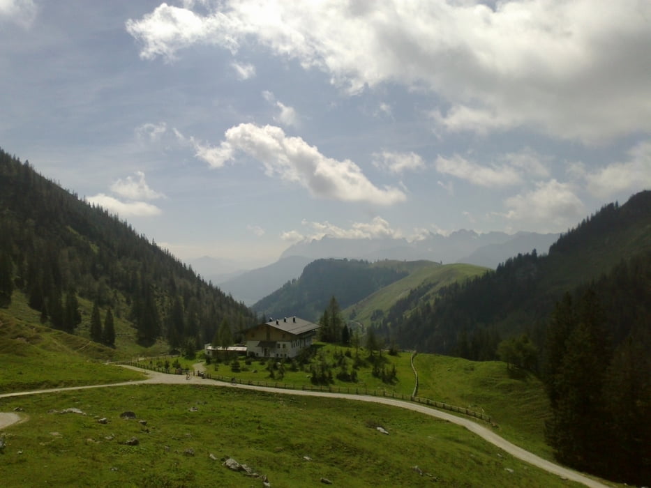
Von der großen Radfahrverbotstafel nicht abschrecken lassen: auf der Hütte wimmelt es nur so von Bikern.
Herrliche, abwechslungsreiche Landschaft mit vielen tollen Einkehrmöglichkeiten!
 

Galerie du tour

Carte du tour et altitude

  • Open Street Map
  • Google
Minimum height 660 m Maximum height 1414 m Vue de détail

More about the tour author

mitter
Member since 2008

Send private message

Commentaires

Start in Walchsee am Dorfplatz.

Tracks GPS

Trackpoints
  • GPX / Garmin Map Source (gpx) download
  • TCX / Garmin Training Center® (tcx) download
  • CRS / Garmin Training Center® (crs) download
  • Google Earth (kml) download
  • G7ToWin (g7t) download
  • TTQV (trk) download
  • Overlay (ovl) download
  • Fugawi (txt) download
  • Kompass (DAV) Track (tk) download
  • Feuille de tours (pdf) download
  • Original file of the author (gpx) download

More about the tour author

mitter
Member since 2008

Send private message
Share track
Add to my favorites
Remove from my favorites
Edit tags
My score
Rate
Tour: Priener Hütte
Cat.: Mountainbike
Longueur: 22,3 km
Evaluated on:
Durée:
Day(s)
Hour(s)
Minute(s)
Evaluation: Paysage Aspect amusement Condition Technique