


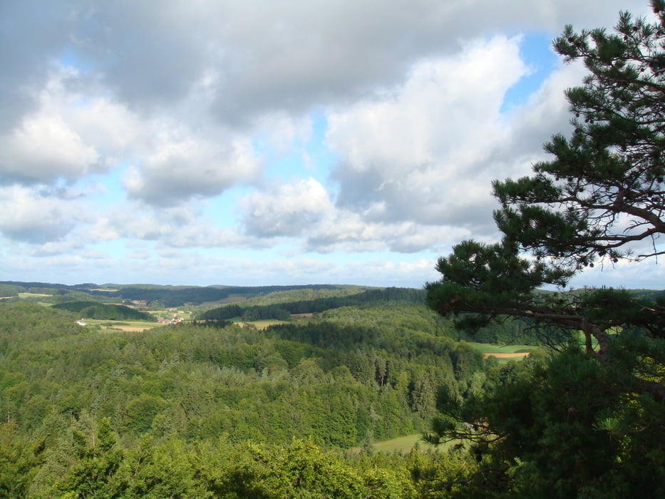
Vom Wanderparkplatz von Obertrubach führt der Weg zuerst durch das liebliche Pitztal. Anschließend gilt es, einen steilen Anstieg in Richtung Leienfels zu überwinden (dieser Anstieg könnte auch umrundet werden). In Leienfels lohnt ein Abstecher zur Burgruine. Von hier hat man einen fabelhaften Blick über die Fränkische Schweiz. An guten Tagen reicht dieser sogar bis ins Fichtelgebirge. Anschließend geht es weiter durch Wälder und an Wiesen vorbei gen Soranger. Die nächste Station ist Bärenfels, ein idylisch gelegenes Dorf. Abschließend führt der Weg leicht absteigend über die Wiesen des Gründleinstal zurück zum Startpunkt dieser Tour.
Galerie du tour


Carte du tour et altitude
Minimum height 426 m
Maximum height 592 m
More about the tour author
|
|
Huthinho |
Commentaires

Von A9 in Richtung Obertrubach. Wanderparkplatz zwischen Obertrubach und Herzogwind.
Tracks GPS
Trackpoints-
GPX / Garmin Map Source (gpx) download
-
TCX / Garmin Training Center® (tcx) download
-
CRS / Garmin Training Center® (crs) download
-
Google Earth (kml) download
-
G7ToWin (g7t) download
-
TTQV (trk) download
-
Overlay (ovl) download
-
Fugawi (txt) download
-
Kompass (DAV) Track (tk) download
-
Feuille de tours (pdf) download
-
Original file of the author (gpx) download
More about the tour author
|
|
Huthinho |
Add to my favorites
Remove from my favorites
Edit tags
Open track
My score
Rate