Login

Login oublié ?

Cookies have to be accepted!
Your browser's cookie functionality is disabled. Please enable this functionality.

Not a member yet?

Register now
Login

Available for registred users only

Log in to use this feature.

Login oublié ?

Cookies have to be accepted!
Your browser's cookie functionality is disabled. Please enable this functionality.

Not a member yet?

Register now
Filter
Catégories
Advanced filters
  • Longueur (km)
  • Altimètre
Enregistrer le filtre Reset filter

TrackRank

QRCode

Technical data

Longueur23,0 km Altimètre0 m Way down0 m Durée02:00 h:m Date30.08.2012
Evaluations Author Paysage Aspect amusement Condition Technique

Statistiques

181 Vues Evaluations 9 Téléchargements Moyenne
Rate
  • Feuille de tours
  • Arrivée
  • Téléchargements

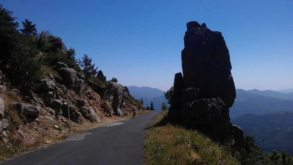
The first part of the uphill is quite steep and on sunny days you will be "kissed by the flame". The partially ruined "Église Saint-Martin de Corsavy" just before reaching the village of Corsavy is definitely worth a stop. In Corsavy refill your bottles at the fountain in the center, this will be your last chance to do so until you reach the Refuge de Batère. After Corsavy the road goes almost flat northward for some km's (nice to prepare for the final uphill).  After passing abandoned old mines and miner's homes you'll finally reach the "Refuge de Batère" (1450m) - enjoy a well earned rest up there (btw: the food is excellent).

If you want you can take a short hike on an unpaved road to the Tour the Batère (the old stone tower you've seen just before reaching the Refuge). The view from this old stone signaltower is stunning (look for other towers in sight, witch which the Tour the Batère was communicating in the past).

Carte du tour et altitude

  • Open Street Map
  • Google
Minimum height 99999 m Maximum height -99999 m Vue de détail

More about the tour author

DonSegafredo
Member since 2011

Send private message

Commentaires

Start west of Arles sur Tech, where the D43 begins. If you came by car, you'll find some place to park there.

Tracks GPS

Trackpoints
  • GPX / Garmin Map Source (gpx) download
  • TCX / Garmin Training Center® (tcx) download
  • CRS / Garmin Training Center® (crs) download
  • Google Earth (kml) download
  • G7ToWin (g7t) download
  • TTQV (trk) download
  • Overlay (ovl) download
  • Fugawi (txt) download
  • Kompass (DAV) Track (tk) download
  • Feuille de tours (pdf) download
  • Original file of the author (gpx) download

More about the tour author

DonSegafredo
Member since 2011

Send private message
Share track
Add to my favorites
Remove from my favorites
Edit tags
My score
Rate
Tour: To the Refuge de Batère
Cat.: Vélo de course
Longueur: 23,0 km
Evaluated on:
Durée:
Day(s)
Hour(s)
Minute(s)
Evaluation: Paysage Aspect amusement Condition Technique