Login

Login oublié ?

Cookies have to be accepted!
Your browser's cookie functionality is disabled. Please enable this functionality.

Not a member yet?

Register now
Login

Available for registred users only

Log in to use this feature.

Login oublié ?

Cookies have to be accepted!
Your browser's cookie functionality is disabled. Please enable this functionality.

Not a member yet?

Register now
Filter
Catégories
Advanced filters
  • Longueur (km)
  • Altimètre
Enregistrer le filtre Reset filter

TrackRank

QRCode

Technical data

Longueur12,7 km Altimètre214 m Way down216 m Durée02:07 h:m Date07.09.2012
Evaluations Author Paysage Aspect amusement Condition Technique

Statistiques

112 Vues Evaluations 17 Téléchargements Moyenne
Rate
  • Feuille de tours
  • Arrivée
  • Téléchargements

29.8.2012

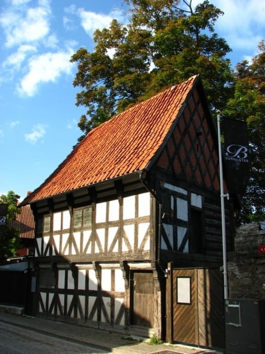
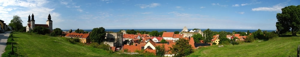
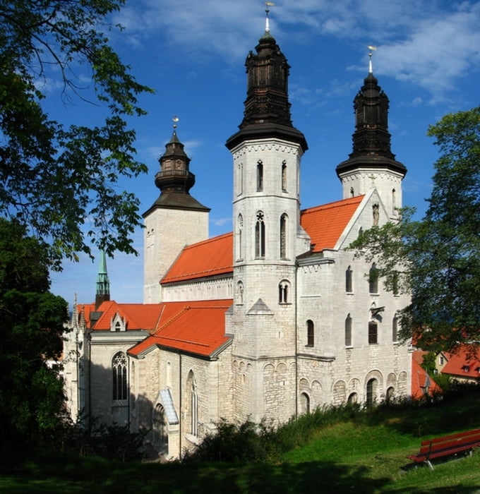
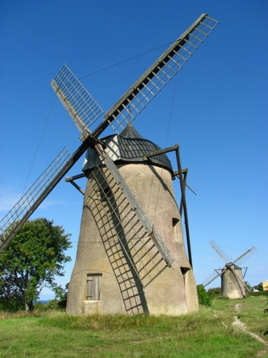
Nový deň. Pobehal som kostoly, ktoré boli včera už zatvorené. Znovu si prešiel nejaké nové zákutia a skočil som aj pozrieť 3 veterné mlyny, ktoré som videl z trajektu. No a preč...

Galerie du tour

Carte du tour et altitude

  • Open Street Map
  • Google
Minimum height -33 m Maximum height 51 m Vue de détail

More about the tour author

tmax
Member since 2007

Send private message

Commentaires

Visby

Tracks GPS

Trackpoints
  • GPX / Garmin Map Source (gpx) download
  • TCX / Garmin Training Center® (tcx) download
  • CRS / Garmin Training Center® (crs) download
  • Google Earth (kml) download
  • G7ToWin (g7t) download
  • TTQV (trk) download
  • Overlay (ovl) download
  • Fugawi (txt) download
  • Kompass (DAV) Track (tk) download
  • Feuille de tours (pdf) download
  • Original file of the author (gpx) download

More about the tour author

tmax
Member since 2007

Send private message
Share track
Add to my favorites
Remove from my favorites
Edit tags
My score
Rate
Tour: 20120829_Visby
Cat.: Randonnées
Longueur: 12,7 km
Evaluated on:
Durée:
Day(s)
Hour(s)
Minute(s)
Evaluation: Paysage Aspect amusement Condition Technique