Login

Login oublié ?

Cookies have to be accepted!
Your browser's cookie functionality is disabled. Please enable this functionality.

Not a member yet?

Register now
Login

Available for registred users only

Log in to use this feature.

Login oublié ?

Cookies have to be accepted!
Your browser's cookie functionality is disabled. Please enable this functionality.

Not a member yet?

Register now
Filter
Catégories
Advanced filters
  • Longueur (km)
  • Altimètre
Enregistrer le filtre Reset filter

TrackRank

QRCode

Technical data

Longueur2,8 km Altimètre113 m Way down94 m Durée01:00 h:m Date08.09.2012
Evaluations Author Paysage Aspect amusement Condition Technique

Statistiques

705 Vues Evaluations 51 Téléchargements Moyenne
Rate
  • Feuille de tours
  • Arrivée
  • Téléchargements

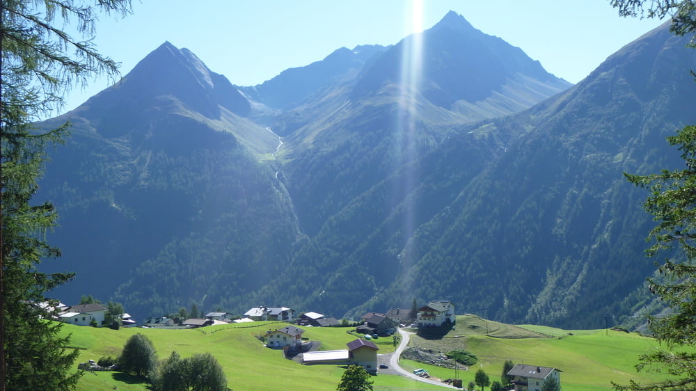
Noch ein "Lückenfüller", wenn z.B. für mehr keine Zeit mehr ist, dann kann man ja den Panoramaweg in Burgstein machen.

1 Stunde schöner Weg mit schöner Ausicht...

Galerie du tour

Carte du tour et altitude

  • Open Street Map
  • Google
Minimum height 1425 m Maximum height 1521 m Vue de détail

More about the tour author

Pointer
Member since 2008

Send private message

Commentaires

Augsburg, München, Wolfratshausen, B 11 Rtg. Innsbruck, Kochelsee, Walchensee, Miittenwald, ehem. Grenzübergang Scharnitz, Seefeld weiter auf B 177 in Rtg. Telfs (mautfreie Strecke), nach Telfs weiter auf B 186 Rtg. Oetz und weiter folgen bis Längenfeld/Burgstein.
 

Tracks GPS

Trackpoints
  • GPX / Garmin Map Source (gpx) download
  • TCX / Garmin Training Center® (tcx) download
  • CRS / Garmin Training Center® (crs) download
  • Google Earth (kml) download
  • G7ToWin (g7t) download
  • TTQV (trk) download
  • Overlay (ovl) download
  • Fugawi (txt) download
  • Kompass (DAV) Track (tk) download
  • Feuille de tours (pdf) download
  • Original file of the author (gpx) download

More about the tour author

Pointer
Member since 2008

Send private message
Share track
Add to my favorites
Remove from my favorites
Edit tags
My score
Rate
Tour: Ötztal: Panoramaweg Burgstein
Cat.: Randonnées
Longueur: 2,8 km
Evaluated on:
Durée:
Day(s)
Hour(s)
Minute(s)
Evaluation: Paysage Aspect amusement Condition Technique