Login

Login oublié ?

Cookies have to be accepted!
Your browser's cookie functionality is disabled. Please enable this functionality.

Not a member yet?

Register now
Login

Available for registred users only

Log in to use this feature.

Login oublié ?

Cookies have to be accepted!
Your browser's cookie functionality is disabled. Please enable this functionality.

Not a member yet?

Register now
Filter
Catégories
Advanced filters
  • Longueur (km)
  • Altimètre
Enregistrer le filtre Reset filter

TrackRank

QRCode

Technical data

Longueur12,0 km Altimètre724 m Way down721 m Durée03:30 h:m Date19.09.2012
Evaluations Author Paysage Aspect amusement Condition Technique

Statistiques

1285 Vues Evaluations 75 Téléchargements Moyenne
Rate
  • Feuille de tours
  • Arrivée
  • Téléchargements

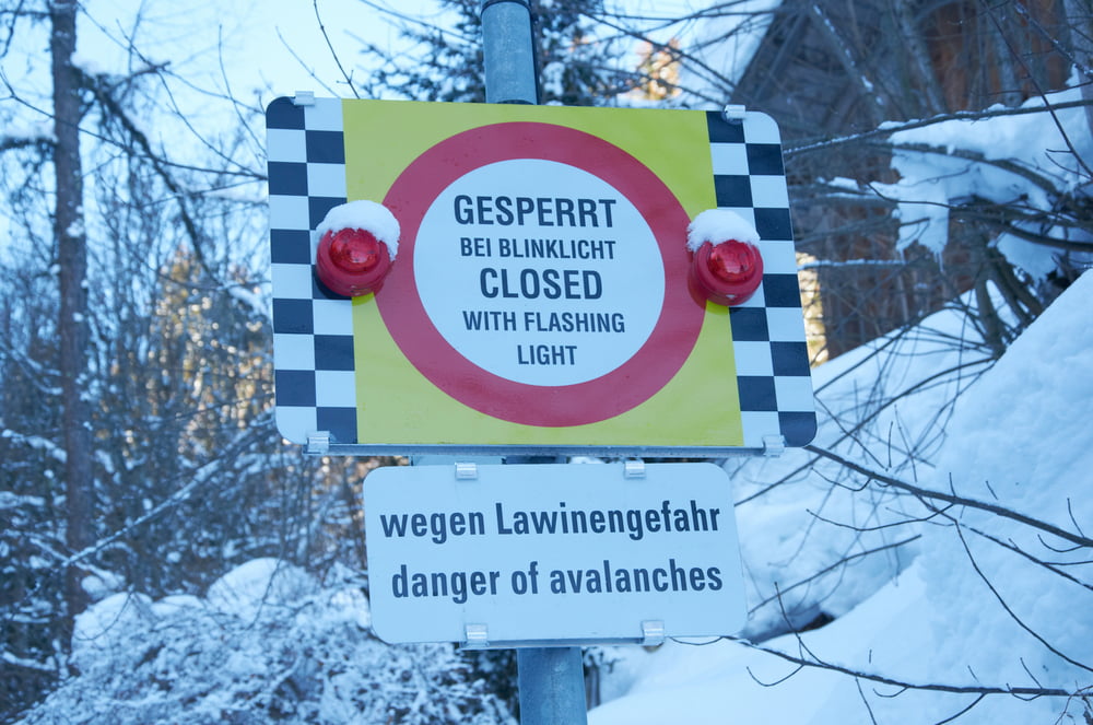
leichte Schneeschuhwanderung stets beschildert. Gute Küche in der Lindauer Hütte, mit dem Bergsteigeressen macht man garantiert nichts falsch. Rückweg ähnlich, aber kaum gleich.


Galerie du tour

Carte du tour et altitude

  • Open Street Map
  • Google
Minimum height 1013 m Maximum height 1770 m Vue de détail

More about the tour author

masterheizer
Member since 2011

Send private message

Commentaires

Parkplatz Skigebiet Golm


Tracks GPS

Trackpoints
  • GPX / Garmin Map Source (gpx) download
  • TCX / Garmin Training Center® (tcx) download
  • CRS / Garmin Training Center® (crs) download
  • Google Earth (kml) download
  • G7ToWin (g7t) download
  • TTQV (trk) download
  • Overlay (ovl) download
  • Fugawi (txt) download
  • Kompass (DAV) Track (tk) download
  • Feuille de tours (pdf) download
  • Original file of the author (gpx) download

More about the tour author

masterheizer
Member since 2011

Send private message
Share track
Add to my favorites
Remove from my favorites
Edit tags
My score
Rate
Tour: Talstation Golm-Lindauer Hütte
Cat.: Raquette
Longueur: 12,0 km
Evaluated on:
Durée:
Day(s)
Hour(s)
Minute(s)
Evaluation: Paysage Aspect amusement Condition Technique