Login

Login oublié ?

Cookies have to be accepted!
Your browser's cookie functionality is disabled. Please enable this functionality.

Not a member yet?

Register now
Login

Available for registred users only

Log in to use this feature.

Login oublié ?

Cookies have to be accepted!
Your browser's cookie functionality is disabled. Please enable this functionality.

Not a member yet?

Register now
Filter
Catégories
Advanced filters
  • Longueur (km)
  • Altimètre
Enregistrer le filtre Reset filter

TrackRank

QRCode

Technical data

Longueur49,2 km Altimètre1688 m Way down1686 m Durée09:00 h:m Date29.09.2012
Evaluations Author Paysage Aspect amusement Condition Technique

Statistiques

365 Vues Evaluations 58 Téléchargements Moyenne
Rate
  • Feuille de tours
  • Arrivée
  • Téléchargements

Tag 3:

Fimberpass (2.605 m)
Beim Downhill super Abfahrts-Flow!
Abstecher nach Sent ins Fahrradgeschäft. Dort auch Mittagspause.
Fahrt nach Sur En am Inn flussabwärts.
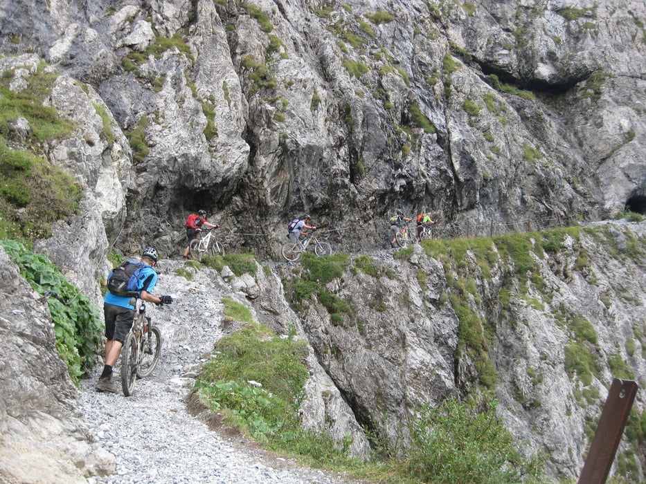
Val d`Uina Schluchtgallerie
Schlinigpass - Passüberschreitung per MTB möglich, sehr flaches Gelände.
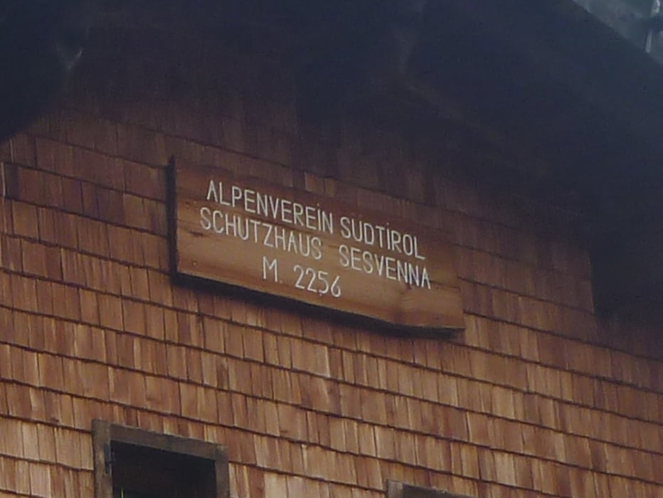
Sesvennahütte
wieder sehr reichhaltiges Abendessen: Gemüsesuppe, Salatbuffet, Nudeln mit Schinken-Sahne-Soße, Bratapfel!
 

Galerie du tour

Carte du tour et altitude

  • Open Street Map
  • Google
Minimum height 1130 m Maximum height 2601 m Vue de détail

More about the tour author

MaximumPower
Member since 2011

Send private message

Commentaires

Abfahrt auf der Heidelberger Hütte:

http://goo.gl/maps/hnO0P

Tracks GPS

Trackpoints
  • GPX / Garmin Map Source (gpx) download
  • TCX / Garmin Training Center® (tcx) download
  • CRS / Garmin Training Center® (crs) download
  • Google Earth (kml) download
  • G7ToWin (g7t) download
  • TTQV (trk) download
  • Overlay (ovl) download
  • Fugawi (txt) download
  • Kompass (DAV) Track (tk) download
  • Feuille de tours (pdf) download
  • Original file of the author (gpx) download

More about the tour author

MaximumPower
Member since 2011

Send private message
Share track
Add to my favorites
Remove from my favorites
Edit tags
My score
Rate
Tour: Mamaleich Alpencross 2012 Tag 3
Cat.: Mountainbike
Longueur: 49,2 km
Evaluated on:
Durée:
Day(s)
Hour(s)
Minute(s)
Evaluation: Paysage Aspect amusement Condition Technique