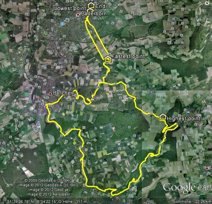
Schoene Tour mit feinen Singletrails aber auch genuegend Möglichkeiten auf Asphalt zu entspannen. Zwischen Helmern und Borchen kann man ganz nach Bedarf noch rechts der Tour Abstecher ins Gelaende machen.
Further information at
http://www.paderborner-land.de/Galerie du tour
Carte du tour et altitude
Minimum height 173 m
Maximum height 351 m
Commentaires

Paderborn und ab darfuer.
Tracks GPS
Trackpoints-
GPX / Garmin Map Source (gpx) download
-
TCX / Garmin Training Center® (tcx) download
-
CRS / Garmin Training Center® (crs) download
-
Google Earth (kml) download
-
G7ToWin (g7t) download
-
TTQV (trk) download
-
Overlay (ovl) download
-
Fugawi (txt) download
-
Kompass (DAV) Track (tk) download
-
Feuille de tours (pdf) download
-
Original file of the author (gpx) download
Add to my favorites
Remove from my favorites
Edit tags
Open track
My score
Rate


