


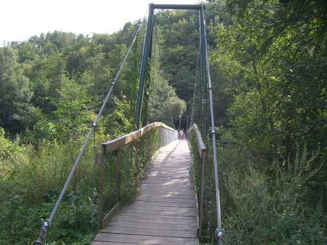
Am Hauptplatz in der Tourist-Info die Radkarte "Retzer Land" gekauft (EUR 3,50). Wir beginnen auf der "6-Städte-Reise" und biegen auf der B35 kurz in den Wünschelroutenweg. Ab Oberretzbach folgen wir dem "Nationalpark Thayatal Radweg". Die asphaltierte, kaum befahrene Strasse führt über Niederfladnitz nach Hardegg. Jenseits der Thaya geht's auf tschechischem Boden weiter. Nach Cizov folgen wir einem wunderschönen Wanderweg (Wegpunkt). Die Abfahrt hinunter zur Thaya ist technisch ein wenig anspruchsvoll. Der Ausblick, der sich einem von oben bietet ist beeindruckend. Über eine hübsche Hängebrücke führt die Route weiter nach Hnanicé. Von dort direkt über den Grenzübergang (keine Kontrolle) zurück nach Retz.
Eine technisch kaum anspruchsvolle, aber sehr nette Radwandertour.
Eine technisch kaum anspruchsvolle, aber sehr nette Radwandertour.
Further information at
http://www.retzer-land.atGalerie du tour
Carte du tour et altitude
Minimum height 236 m
Maximum height 468 m
More about the tour author

|
Commentaires

Mit dem Zug um 09:55 von Wien-Rennweg direkt nach Retz (Ankunft 11:11). Retour um 19:19, Ankunft 20:34.
Tracks GPS
Trackpoints-
GPX / Garmin Map Source (gpx) download
-
TCX / Garmin Training Center® (tcx) download
-
CRS / Garmin Training Center® (crs) download
-
Google Earth (kml) download
-
G7ToWin (g7t) download
-
TTQV (trk) download
-
Overlay (ovl) download
-
Fugawi (txt) download
-
Kompass (DAV) Track (tk) download
-
Feuille de tours (pdf) download
-
Original file of the author (gpx) download
More about the tour author
|
|
Add to my favorites
Remove from my favorites
Edit tags
Open track
My score
Rate