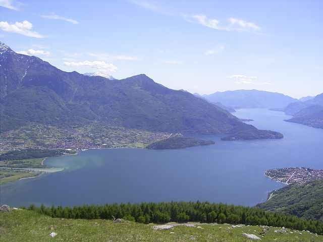
Auffahrt zum Mt. Mezzo Startplatz
geteerte Straße bis zum Startplatz, ab halber Strecke einspurig und mit recht engen Kurven und wenig Ausweichmöglichkeiten. Ca. 2km vor dem Startplatz ist ein Fahrverbotsschild (, an das sich aber niemand hält).
Details siehe link
am Morgen fliegen, wegen Breva
geteerte Straße bis zum Startplatz, ab halber Strecke einspurig und mit recht engen Kurven und wenig Ausweichmöglichkeiten. Ca. 2km vor dem Startplatz ist ein Fahrverbotsschild (, an das sich aber niemand hält).
Details siehe link
am Morgen fliegen, wegen Breva
Further information at
http://www.paragliding365.com/index-p-flightarea_details_5097.htmlGalerie du tour
Carte du tour et altitude
Minimum height 180 m
Maximum height 1230 m
Commentaires

Splügen, Chiavenna, dann auf ss36 bis Gera Lario. Richtung Lugano
Tracks GPS
Trackpoints-
GPX / Garmin Map Source (gpx) download
-
TCX / Garmin Training Center® (tcx) download
-
CRS / Garmin Training Center® (crs) download
-
Google Earth (kml) download
-
G7ToWin (g7t) download
-
TTQV (trk) download
-
Overlay (ovl) download
-
Fugawi (txt) download
-
Kompass (DAV) Track (tk) download
-
Feuille de tours (pdf) download
-
Original file of the author (gpx) download
Add to my favorites
Remove from my favorites
Edit tags
Open track
My score
Rate


