Schöne Rundwanderung - Dreitälerwnderung Sieg, Erlebnisweg Sieg - von/bis Blankenberg
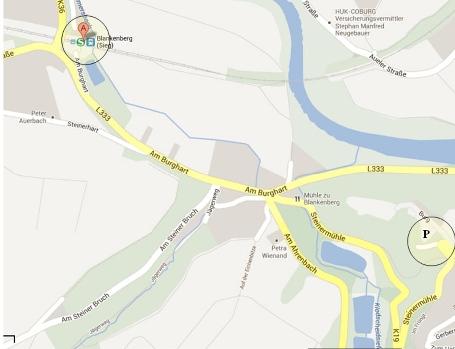
Tourbeginn: Bahnhof Blankenberg (Sieg oder Parkplatz Blankenberg-Burg
Galerie du tour
Carte du tour et altitude
Minimum height 76 m
Maximum height 251 m
Commentaires

Auto: A560 bis Ende -Links L333:Europaallee/Dondorfer Str. bis Blankenberg
Bahn:Von Siegburg HBF mirt der S12 Richtung Au (Sieg) - Bahnhof Blankenberg
Tracks GPS
Trackpoints-
GPX / Garmin Map Source (gpx) download
-
TCX / Garmin Training Center® (tcx) download
-
CRS / Garmin Training Center® (crs) download
-
Google Earth (kml) download
-
G7ToWin (g7t) download
-
TTQV (trk) download
-
Overlay (ovl) download
-
Fugawi (txt) download
-
Kompass (DAV) Track (tk) download
-
Feuille de tours (pdf) download
-
Original file of the author (gpx) download
Add to my favorites
Remove from my favorites
Edit tags
Open track
My score
Rate


