Login

Login oublié ?

Cookies have to be accepted!
Your browser's cookie functionality is disabled. Please enable this functionality.

Not a member yet?

Register now
Login

Available for registred users only

Log in to use this feature.

Login oublié ?

Cookies have to be accepted!
Your browser's cookie functionality is disabled. Please enable this functionality.

Not a member yet?

Register now
Filter
Catégories
Advanced filters
  • Longueur (km)
  • Altimètre
Enregistrer le filtre Reset filter

TrackRank

QRCode

Technical data

Longueur57,7 km Altimètre1638 m Way down1636 m Durée04:56 h:m Date28.07.2013
Evaluations Author Paysage Aspect amusement Condition Technique

Statistiques

379 Vues Evaluations 52 Téléchargements Moyenne
Rate
  • Feuille de tours
  • Arrivée
  • Téléchargements

Spittal-Seebach-Kötzing-Kolm-Trasischk-Treffling-
Hansbauer Hütte-Tschiernock-Oberbuch-Gmünd-Spittal

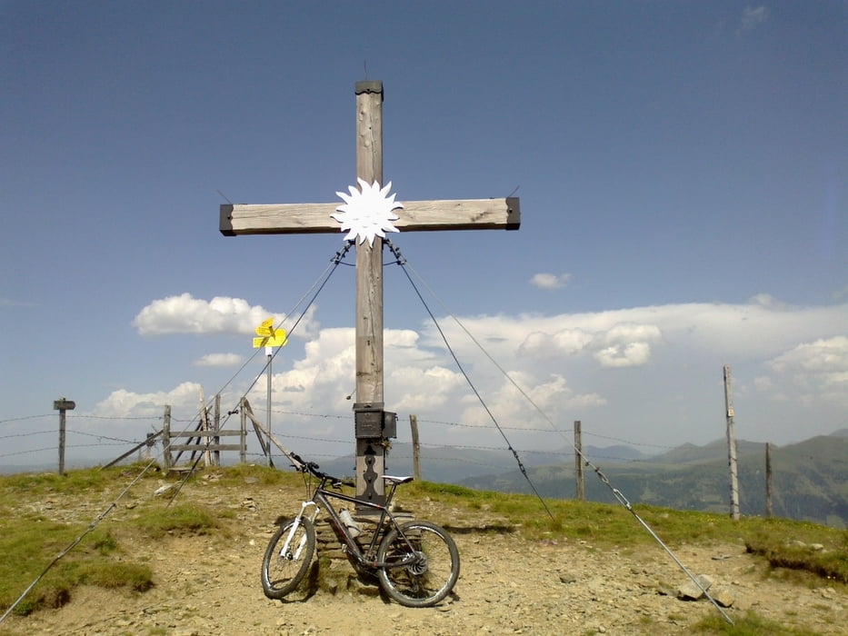
Die Überschreitung ist also möglich mit relativ wenig Geschiebe: ein bisschen zum und vom Gipfel.


Galerie du tour

Carte du tour et altitude

  • Open Street Map
  • Google
Minimum height 568 m Maximum height 2078 m Vue de détail

More about the tour author

mitter
Member since 2008

Send private message

Commentaires

Start in Spittal beim Spital.


Tracks GPS

Trackpoints
  • GPX / Garmin Map Source (gpx) download
  • TCX / Garmin Training Center® (tcx) download
  • CRS / Garmin Training Center® (crs) download
  • Google Earth (kml) download
  • G7ToWin (g7t) download
  • TTQV (trk) download
  • Overlay (ovl) download
  • Fugawi (txt) download
  • Kompass (DAV) Track (tk) download
  • Feuille de tours (pdf) download
  • Original file of the author (gpx) download

More about the tour author

mitter
Member since 2008

Send private message
Share track
Add to my favorites
Remove from my favorites
Edit tags
My score
Rate
Tour: Tschiernocküberschreitung
Cat.: Mountainbike
Longueur: 57,7 km
Evaluated on:
Durée:
Day(s)
Hour(s)
Minute(s)
Evaluation: Paysage Aspect amusement Condition Technique