


- Tour im Uhrzeigersinn
- Start/Ziel: Torbole-Hotel Santa Lucia(super Bike-Hotel)
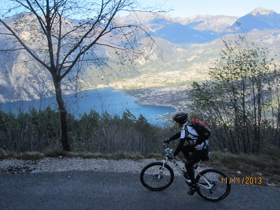
- 80 MH-1.550 MH 14 KM Teerstrasse; mittelsteil; rythmisch
- 1.550 MH-1.714 MH 1,3 KM Strasse steiniger Untergrund.
- 1.714 MH-2.060 MH 2,5 KM schieben bis zum Monte Altissimo.
- 2.060 MH-1.614 MH 4 KM Abfahrt auf steiniger Militärstrasse.
- 1.440 MH-1.752 MH 3 KM Aufstieg Monte Baldo-Seilbahn Bergstation (mittelsteil+)
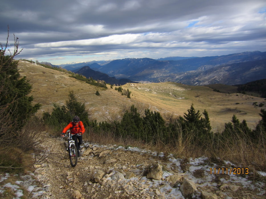
- 1.752 MH-1.360 MH - sehr anspruchsvoller Trail, nur teilweise befahrbar
- 1.360 MH- 100 MH - nach Malcesine Schotterstrasse, Teilstücke betoniert.
- 14 KM von Malcesine nachTorbole auf Hauptstrasse, einige kurze Tunnel (Radbeleuchtung nicht vergessen).
Galerie du tour

Carte du tour et altitude
Minimum height 57 m
Maximum height 2064 m
More about the tour author
|
|
MargesinFriedrich |
Commentaires

Tracks GPS
Trackpoints-
GPX / Garmin Map Source (gpx) download
-
TCX / Garmin Training Center® (tcx) download
-
CRS / Garmin Training Center® (crs) download
-
Google Earth (kml) download
-
G7ToWin (g7t) download
-
TTQV (trk) download
-
Overlay (ovl) download
-
Fugawi (txt) download
-
Kompass (DAV) Track (tk) download
-
Feuille de tours (pdf) download
-
Original file of the author (gpx) download
More about the tour author
|
|
MargesinFriedrich |
Add to my favorites
Remove from my favorites
Edit tags
Open track
My score
Rate