Login

Login oublié ?

Cookies have to be accepted!
Your browser's cookie functionality is disabled. Please enable this functionality.

Not a member yet?

Register now
Login

Available for registred users only

Log in to use this feature.

Login oublié ?

Cookies have to be accepted!
Your browser's cookie functionality is disabled. Please enable this functionality.

Not a member yet?

Register now
Filter
Catégories
Advanced filters
  • Longueur (km)
  • Altimètre
Enregistrer le filtre Reset filter

TrackRank

QRCode

Technical data

Longueur28,3 km Altimètre1832 m Way down1845 m Durée09:00 h:m Date28.01.2014
Evaluations Author Paysage Aspect amusement Condition Technique

Statistiques

2583 Vues Evaluations 31 Téléchargements Moyenne
Rate
  • Feuille de tours
  • Arrivée
  • Téléchargements

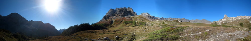
Partenza a piedi da Pian del Colle o data la lunghezza anche dal Rifugio 3° Alpini in Valle Stretta.

Il dislivello è notevole da 1500/1900 fino a 3200 ma ne vale la pena per gli scenari unici.


Further information at

http://trumpyroberto.zonerama.com/Album/254978

Galerie du tour

Carte du tour et altitude

  • Open Street Map
  • Google
Minimum height 1455 m Maximum height 3178 m Vue de détail

More about the tour author

Trumpy
Member since 2014

Send private message

Commentaires

Da Bardonecchia la strada per Melezet e proseguire fino al confine o al massimo al Rif. 3° Alpini.


Tracks GPS

Trackpoints
  • GPX / Garmin Map Source (gpx) download
  • TCX / Garmin Training Center® (tcx) download
  • CRS / Garmin Training Center® (crs) download
  • Google Earth (kml) download
  • G7ToWin (g7t) download
  • TTQV (trk) download
  • Overlay (ovl) download
  • Fugawi (txt) download
  • Kompass (DAV) Track (tk) download
  • Feuille de tours (pdf) download
  • Original file of the author (gpx) download

More about the tour author

Trumpy
Member since 2014

Send private message
Share track
Add to my favorites
Remove from my favorites
Edit tags
My score
Rate
Tour: Monte Tabor da Bardonecchia, Valle Stretta
Cat.: Tour en montagne
Longueur: 28,3 km
Evaluated on:
Durée:
Day(s)
Hour(s)
Minute(s)
Evaluation: Paysage Aspect amusement Condition Technique