Login

Login oublié ?

Cookies have to be accepted!
Your browser's cookie functionality is disabled. Please enable this functionality.

Not a member yet?

Register now
Login

Available for registred users only

Log in to use this feature.

Login oublié ?

Cookies have to be accepted!
Your browser's cookie functionality is disabled. Please enable this functionality.

Not a member yet?

Register now
Filter
Catégories
Advanced filters
  • Longueur (km)
  • Altimètre
Enregistrer le filtre Reset filter

TrackRank

QRCode

Technical data

Longueur9,7 km Altimètre428 m Way down435 m Durée03:00 h:m Date01.02.2014
Evaluations Author Paysage Aspect amusement Condition Technique

Statistiques

361 Vues Evaluations 53 Téléchargements Moyenne
Rate
  • Feuille de tours
  • Arrivée
  • Téléchargements

Rundtour - Oberschwarzenberg - Salzsteig - Dreiländereck - Bayrischer Plöckenstein -  Dreisesselberg - Witikosteig retour nach Oberschwarzenberg


Dies ist eine Ganzjahreswandertour . Im Winter entweder mit Schneeschuhen bei Neuschnee, oder Wanderschuhen. Der Weg ist gut frequentiert daher immer gut ausgetreten. Einkehrmöglichkeit - kleiner Abstecher von ca 10 Minuten (hin und retour) - beim Dreisesselberghaus.


Galerie du tour

Carte du tour et altitude

  • Open Street Map
  • Google
Minimum height 927 m Maximum height 1363 m Vue de détail

More about the tour author

Hoar
Member since 2009

Send private message

Commentaires

Start und Ziel ist der Parkplatz am Ende der Straße bei Oberschwarzenberg

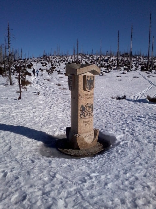
Reisepass nicht vergessen

Tracks GPS

Trackpoints
  • GPX / Garmin Map Source (gpx) download
  • TCX / Garmin Training Center® (tcx) download
  • CRS / Garmin Training Center® (crs) download
  • Google Earth (kml) download
  • G7ToWin (g7t) download
  • TTQV (trk) download
  • Overlay (ovl) download
  • Fugawi (txt) download
  • Kompass (DAV) Track (tk) download
  • Feuille de tours (pdf) download
  • Original file of the author (gpx) download

More about the tour author

Hoar
Member since 2009

Send private message
Share track
Add to my favorites
Remove from my favorites
Edit tags
My score
Rate
Tour: Winterautobahn am Böhmerwaldkamm - Dreiländereck Bayrischer Plöckenstein Dreisesselberg
Cat.: Randonnées
Longueur: 9,7 km
Evaluated on:
Durée:
Day(s)
Hour(s)
Minute(s)
Evaluation: Paysage Aspect amusement Condition Technique