Login

Login oublié ?

Cookies have to be accepted!
Your browser's cookie functionality is disabled. Please enable this functionality.

Not a member yet?

Register now
Login

Available for registred users only

Log in to use this feature.

Login oublié ?

Cookies have to be accepted!
Your browser's cookie functionality is disabled. Please enable this functionality.

Not a member yet?

Register now
Filter
Catégories
Advanced filters
  • Longueur (km)
  • Altimètre
Enregistrer le filtre Reset filter

TrackRank

QRCode

Technical data

Longueur10,8 km Altimètre90 m Way down90 m Durée00:00 h:m Date17.03.2014
Evaluations Author Paysage Aspect amusement Condition Technique

Statistiques

663 Vues Evaluations 27 Téléchargements Moyenne
Rate
  • Feuille de tours
  • Arrivée
  • Téléchargements

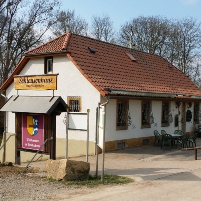
Startpunkt der Tour ist ein kleiner Parkplatz direkt beim Schleusenhaus. Die gemütliche kleine Wanderung führt zunächst über die Schleuse und anschließend auf gut ausgebauten Forstwirtschaftswegen durch den Auwald. Die Stecke verläuft ausschließlich in der Ebene und enthält keine Steigungen, Quasi parallel geht es bis zum Altrhein und danach entlang des Rheins wieder zurück zum Schleusenhaus.


Galerie du tour

Carte du tour et altitude

  • Open Street Map
  • Google
Minimum height 84 m Maximum height 117 m Vue de détail

More about the tour author

isg13
Member since 2010

Send private message

Commentaires

Tracks GPS

Trackpoints
  • GPX / Garmin Map Source (gpx) download
  • TCX / Garmin Training Center® (tcx) download
  • CRS / Garmin Training Center® (crs) download
  • Google Earth (kml) download
  • G7ToWin (g7t) download
  • TTQV (trk) download
  • Overlay (ovl) download
  • Fugawi (txt) download
  • Kompass (DAV) Track (tk) download
  • Feuille de tours (pdf) download
  • Original file of the author (gpx) download

More about the tour author

isg13
Member since 2010

Send private message
Share track
Add to my favorites
Remove from my favorites
Edit tags
My score
Rate
Tour: Pfälzer Rundwanderung mit Einkehr - Schleusenhaus Sondernheim
Cat.: Randonnées
Longueur: 10,8 km
Evaluated on:
Durée:
Day(s)
Hour(s)
Minute(s)
Evaluation: Paysage Aspect amusement Condition Technique