


BikeTube HD 05
das Neckartal - Etappe 1: von Schwenningen-Tübingen
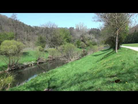
Auf dieser ersten Etappe durch das Neckartal braucht es Sitzfleisch.
Wir starten in Schwenningen am Bahnhof erkunden das Schwenninger Moos, das Quellgebiet des knapp 400 km langen Neckar.
Offiziell beginnt der Neckartalradweg im Stadtpark Möglingshöhe in Schwenningen.
Bis Rottweil gilt es die meiste Arbeit zu verrichten. Auf den ersten 40 km fallen die meisten Höhenmeter an. In Rottweil weichen wir vom Radweg ab um die geschichtsträchtige Innenstadt zu besichtigen und natürlich auch für einen Imbiss.
Steigungen halten uns nun nicht mehr auf - es gibt keine.
Wir lassen fliegen und ist Horb erreicht könnte man neben einer Kaffeepause die Altstadt besuchen.
Rottenburg wäre ein nächster Spot für eine Pause aber bis Tübingen unserem heutigen Etappenziel ist es noch ein Stück.
Further information at
https://www.youtube.com/watch?feature=player_embedded&v=nqstnOLdFdgGalerie du tour
Carte du tour et altitude
Minimum height 318 m
Maximum height 709 m
More about the tour author
|
|
Berndinho |
Commentaires

Anreise mit der Bahn nach Schwenningen.
Tracks GPS
Trackpoints-
GPX / Garmin Map Source (gpx) download
-
TCX / Garmin Training Center® (tcx) download
-
CRS / Garmin Training Center® (crs) download
-
Google Earth (kml) download
-
G7ToWin (g7t) download
-
TTQV (trk) download
-
Overlay (ovl) download
-
Fugawi (txt) download
-
Kompass (DAV) Track (tk) download
-
Feuille de tours (pdf) download
-
Original file of the author (gpx) download
More about the tour author
|
|
Berndinho |
Add to my favorites
Remove from my favorites
Edit tags
Open track
My score
Rate