


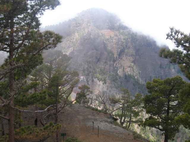
Tolle Wanderung am Pico Bejanado (1854m) mit super Blick auf Cumbrecita aber steiler Auf- bzw. Abstieg.Da dichter Nebel aufzog war ich leider nicht ganz oben.
Tipp: Bin manche Touren des Rother Wanderführes "rückwärts" gegangen, da ich lieber steil hoch als runter gehe.Die Petroglyphen von Tamarahoya waren eingezäunt
und Zugangstür verschlossen (06/2007). Evtl.im Nationalpark-Center nachfragen.
Tipp: Bin manche Touren des Rother Wanderführes "rückwärts" gegangen, da ich lieber steil hoch als runter gehe.Die Petroglyphen von Tamarahoya waren eingezäunt
und Zugangstür verschlossen (06/2007). Evtl.im Nationalpark-Center nachfragen.
Galerie du tour
Carte du tour et altitude
Minimum height 1141 m
Maximum height 1616 m
More about the tour author

|
martin999 |
Commentaires

von El Paso > Santa Cruz am Nationalpark-Center links > Cumbrecita nach 1Km liks > Pico Bejanado (letztes Stück Schotterpiste)
Tracks GPS
Trackpoints-
GPX / Garmin Map Source (gpx) download
-
TCX / Garmin Training Center® (tcx) download
-
CRS / Garmin Training Center® (crs) download
-
Google Earth (kml) download
-
G7ToWin (g7t) download
-
TTQV (trk) download
-
Overlay (ovl) download
-
Fugawi (txt) download
-
Kompass (DAV) Track (tk) download
-
Feuille de tours (pdf) download
-
Original file of the author (gpx) download
More about the tour author
|
|
martin999 |
Add to my favorites
Remove from my favorites
Edit tags
Open track
My score
Rate