


Eine weitere Variante von Schwarzenbach nach Kirkel und zurück.
Der Rückweg erfolgte nördlich der Kaiserstraße auf einem schönen Radweg bis nach Limbach. Dort bog ich auf die Adebar Route ein und fuhr durch das Bliestal an den Herden der Highland Cattle und Wasserbüffel vorbei zurück nach Schwarzenbach.
Further information at
http://www.kirkel.de/Galerie du tour

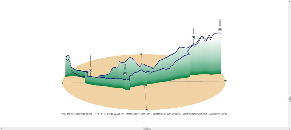
Carte du tour et altitude
Minimum height 229 m
Maximum height 294 m
More about the tour author
|
|
Pheinz |
Commentaires

In Schwarzenbach geht es los
Tracks GPS
Trackpoints-
GPX / Garmin Map Source (gpx) download
-
TCX / Garmin Training Center® (tcx) download
-
CRS / Garmin Training Center® (crs) download
-
Google Earth (kml) download
-
G7ToWin (g7t) download
-
TTQV (trk) download
-
Overlay (ovl) download
-
Fugawi (txt) download
-
Kompass (DAV) Track (tk) download
-
Feuille de tours (pdf) download
-
Original file of the author (gpx) download
More about the tour author
|
|
Pheinz |
Add to my favorites
Remove from my favorites
Edit tags
Open track
My score
Rate