


Flache Variante zwischen Schwarzenacker und Kirkel.
Der Rückweg führte auf dem schönen Radweg bis zum Gewerbegebiet und durch dieses hindurch.
An der Weggabelung hielt ich mich links und fuhr kurz danach bis zur Blies und seinen Biotopen hinunter.
Further information at
http://www.caigos.de/Galerie du tour
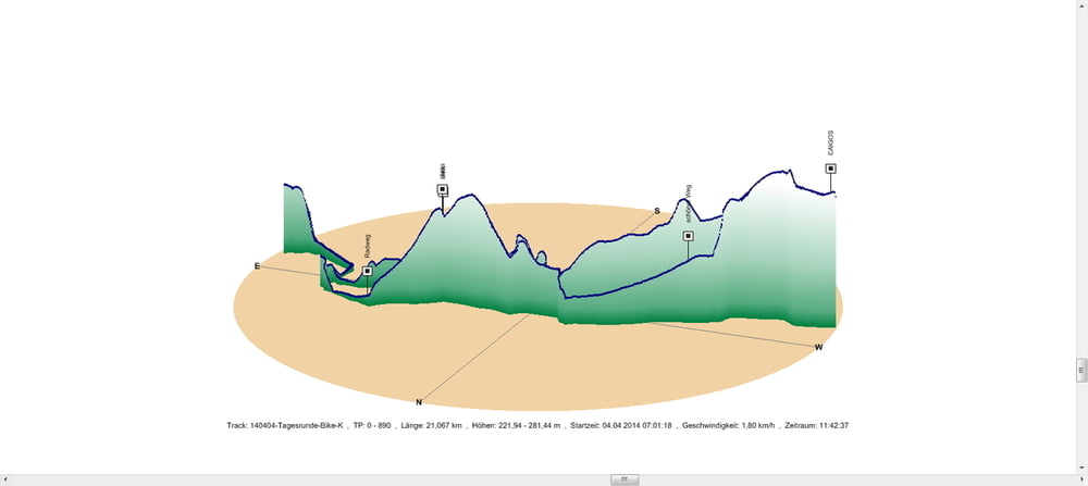
Carte du tour et altitude
Minimum height 222 m
Maximum height 281 m
More about the tour author
|
|
Pheinz |
Commentaires

In Schwarzenbach geht es los.
Tracks GPS
Trackpoints-
GPX / Garmin Map Source (gpx) download
-
TCX / Garmin Training Center® (tcx) download
-
CRS / Garmin Training Center® (crs) download
-
Google Earth (kml) download
-
G7ToWin (g7t) download
-
TTQV (trk) download
-
Overlay (ovl) download
-
Fugawi (txt) download
-
Kompass (DAV) Track (tk) download
-
Feuille de tours (pdf) download
-
Original file of the author (gpx) download
More about the tour author
|
|
Pheinz |
Add to my favorites
Remove from my favorites
Edit tags
Open track
My score
Rate