

Il pullman ci lascia a Villanova, località di Borca di Cadore dove inizia l'escursione. Il primo tratto di percorso avviene su stradina asfaltata per poi continuare in mezzo al bosco che diventa strada forestale e poi sentiero. Tutto ben segnalato fin da l'inizio.
Una bella camminata con buon dislivello per circa 8 km fino al rif. Venezia; il sentiero continua in quota con qualche sali scendo per poi scendere leggermente fino al punto d'arrivo di rif. Staulanza dove era pronto il pullman per il rientro.
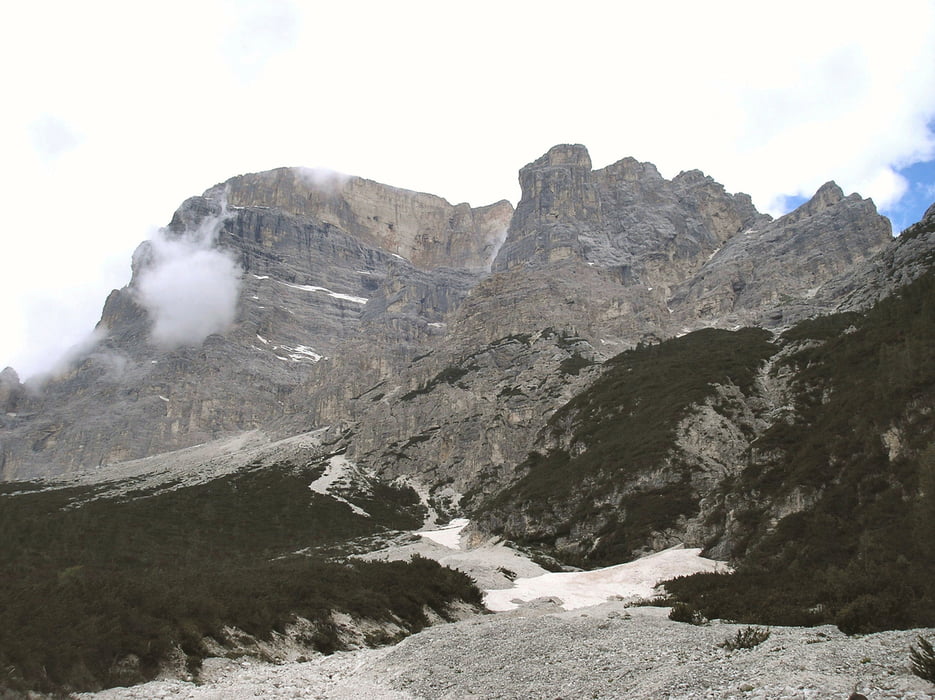
Stupenda immagine del gruppo del Pelmo visto da ovest-sud-est ancora con qualche nevaio.
Further information at
http://www.magicoveneto.it/dolomiti/Pelmo/Sentieri-Pelmo.htmGalerie du tour


Carte du tour et altitude
Minimum height 930 m
Maximum height 1986 m
More about the tour author
|
|
agosflavio |
Commentaires

Provenendo da Belluno, Borca di Cadore si trova ad una ventina di km da Cortina d'Ampezzo, mentre il rifugio Passo Staulanza si trova nella vallata di Zoldo, (Val Zoldana) e inizia ad ovest di Longarone difronte la diga di Vajont dove si prosegue per km 40 circa.
Tracks GPS
Trackpoints-
GPX / Garmin Map Source (gpx) download
-
TCX / Garmin Training Center® (tcx) download
-
CRS / Garmin Training Center® (crs) download
-
Google Earth (kml) download
-
G7ToWin (g7t) download
-
TTQV (trk) download
-
Overlay (ovl) download
-
Fugawi (txt) download
-
Kompass (DAV) Track (tk) download
-
Feuille de tours (pdf) download
-
Original file of the author (gpx) download
More about the tour author
|
|
agosflavio |
Add to my favorites
Remove from my favorites
Edit tags
Open track
My score
Rate