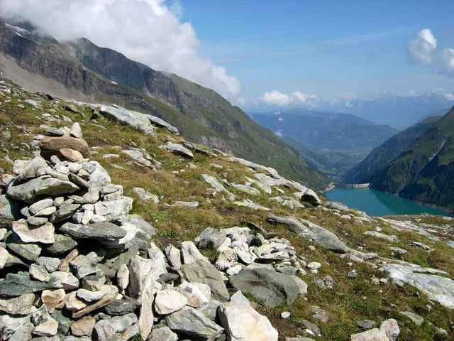
SK: Track štartuje pri značkovom rázcestí neďaleko horskej reštaurácie Mooserboden. Stúpame vrstevnicou západneho svahu po turistickom chodníku. Ako stúpame, otvárajú sa nám zaujímavé výhľady nielen na obe priehrady, ale aj na majestátne ľadovce Glocknergruppe. Chodník sa po čase stáča postupne na sever, dochádza k dokonca jeho miernemu klesaniu. Ešte zostáva prekonať pár výškových metrov a stojíme v sedle Kleine Griesskogel vo výške 2669 m n.m. Kto má primeranú obuv a počasie nie je práve proti, môže pokoriť hranicu troch tisícov na ceste ku Grosse Griesskogel.
DE: Vom Bergrestaurant Mooserboden gelangt man auf der Westseite auf einem gut markierten Weg (Nr. 734) über terrassenartige Grashänge auf einen breiten, flachen Rücken, der mit Steinmännern markiert ist. Hier beginnt der Nationalpark. Nun wandert man aufwärts bis zum Sedlgrat (2.541 m). Es folgt ein kurzer Abstieg und dann rechts eine Abzweigung zum Gipfel des Kleinen Grießkogels auf 2.669 m Seehöhe. (Quelle: www.tauerntouristik.at)
DE: Vom Bergrestaurant Mooserboden gelangt man auf der Westseite auf einem gut markierten Weg (Nr. 734) über terrassenartige Grashänge auf einen breiten, flachen Rücken, der mit Steinmännern markiert ist. Hier beginnt der Nationalpark. Nun wandert man aufwärts bis zum Sedlgrat (2.541 m). Es folgt ein kurzer Abstieg und dann rechts eine Abzweigung zum Gipfel des Kleinen Grießkogels auf 2.669 m Seehöhe. (Quelle: www.tauerntouristik.at)
Further information at
http://www.tauerntouristik.at/de/kaprun/index.phpGalerie du tour
Carte du tour et altitude
Minimum height 2042 m
Maximum height 2677 m
Commentaires

Über die B168 (von Mittersill) oder die B311 (von Lofer oder St. Johann) bis nach Kaprun. In Kaprun auf der Umfahrungsstrasse südwärts über den Talschluss (ca. 7 km vom Umfahrungstunnel) zum Alpengasthof Kesselfall. Von dort mit dem Bus und Schrägaufzug bis zum Stausee Mooserboden. (Quelle: www.tauerntouristik.at)
Tracks GPS
Trackpoints-
GPX / Garmin Map Source (gpx) download
-
TCX / Garmin Training Center® (tcx) download
-
CRS / Garmin Training Center® (crs) download
-
Google Earth (kml) download
-
G7ToWin (g7t) download
-
TTQV (trk) download
-
Overlay (ovl) download
-
Fugawi (txt) download
-
Kompass (DAV) Track (tk) download
-
Feuille de tours (pdf) download
-
Original file of the author (gpx) download
Add to my favorites
Remove from my favorites
Edit tags
Open track
My score
Rate


