


Start ist beim Camping Safari nahe Ulcinj. Zunächst geht es auf geteerten Straßen bis Ulcinj, bevor es abzweigt Richtung Mozura. Sobald es ansteigt verwandelt sich die Straße in einen Schotterweg, die steilsten Anstiege sind betoniert. Was gut ist, sonst wären sie kaum fahrbar.
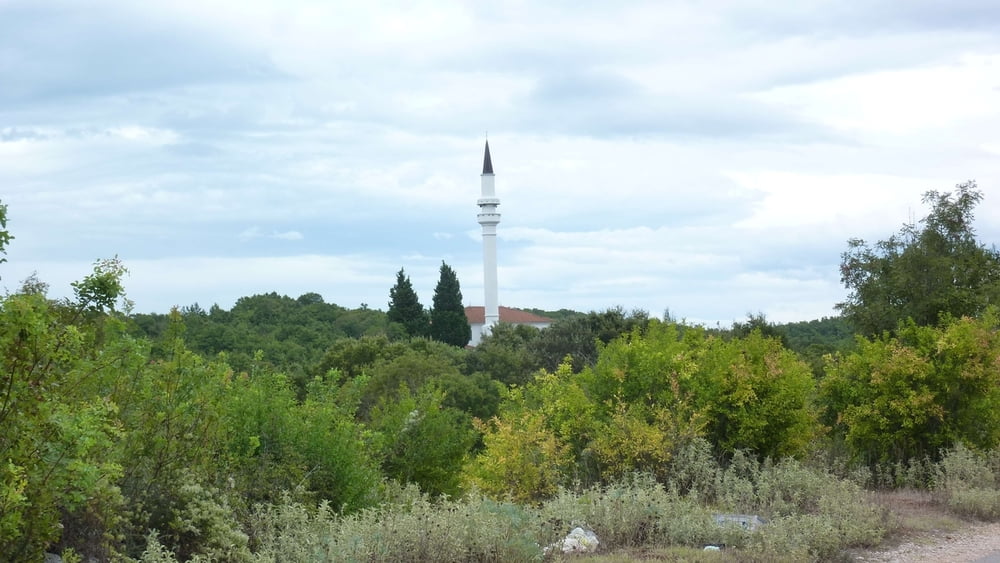
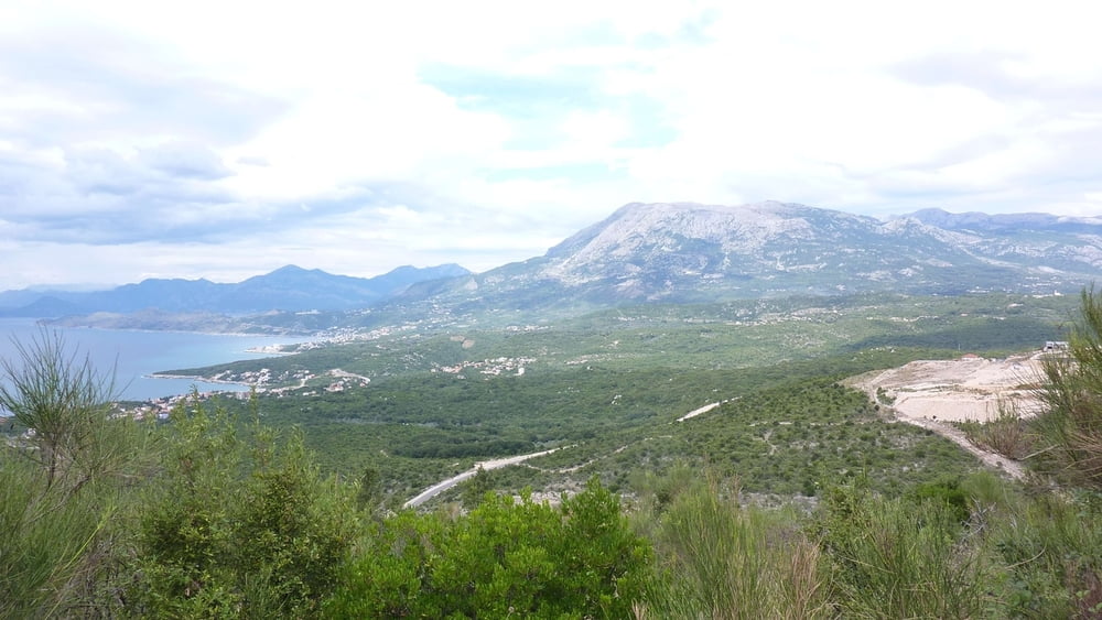
Zunächst steigt es kräftig an bis zu Kapelle. Dann geht es mehr oder weniger eben den Berg entlang mit schönen Ausblicken nach Ulcinj, Albanien und in die Bucht von Kruce. An der westlichen Flanke des Mozura fällt die Strecke wieder ab bevor wir wieder auf eine geteerte Straße treffen, auf der wir über Dörfer, vorbei an ein paar Minaretten auf und ab fahren. Dabei haben wir schöne Blicke auf das Rumija Massiv im Norden, das weitere, schöne Touren erahnen lässt. Auf steiler Abfahrt fahren wir zur M2.4 hinunter, die sich durch einen Canyon schlängelt. Auf ihr rollen wir zurück nach Ulcinj und schließlich zum Camping Safari.
Galerie du tour


Carte du tour et altitude
Minimum height -4 m
Maximum height 336 m
More about the tour author
|
|
buehlems |
Commentaires

Ulcinj, Ri. Bojana, dann Beschilderung Camping Safari folgen.
Start in Ulcinj ist genauso möglich.
Tracks GPS
Trackpoints-
GPX / Garmin Map Source (gpx) download
-
TCX / Garmin Training Center® (tcx) download
-
CRS / Garmin Training Center® (crs) download
-
Google Earth (kml) download
-
G7ToWin (g7t) download
-
TTQV (trk) download
-
Overlay (ovl) download
-
Fugawi (txt) download
-
Kompass (DAV) Track (tk) download
-
Feuille de tours (pdf) download
-
Original file of the author (gpx) download
More about the tour author
|
|
buehlems |
Add to my favorites
Remove from my favorites
Edit tags
Open track
My score
Rate