Login

Login oublié ?

Cookies have to be accepted!
Your browser's cookie functionality is disabled. Please enable this functionality.

Not a member yet?

Register now
Login

Available for registred users only

Log in to use this feature.

Login oublié ?

Cookies have to be accepted!
Your browser's cookie functionality is disabled. Please enable this functionality.

Not a member yet?

Register now
Filter
Catégories
Advanced filters
  • Longueur (km)
  • Altimètre
Enregistrer le filtre Reset filter

TrackRank

QRCode

Technical data

Longueur12,8 km Altimètre653 m Way down657 m Durée1 day 1 h Date14.11.2014
Evaluations Author Paysage Aspect amusement Condition Technique

Statistiques

1403 Vues Evaluations 140 Téléchargements Moyenne
Rate
  • Feuille de tours
  • Arrivée
  • Téléchargements

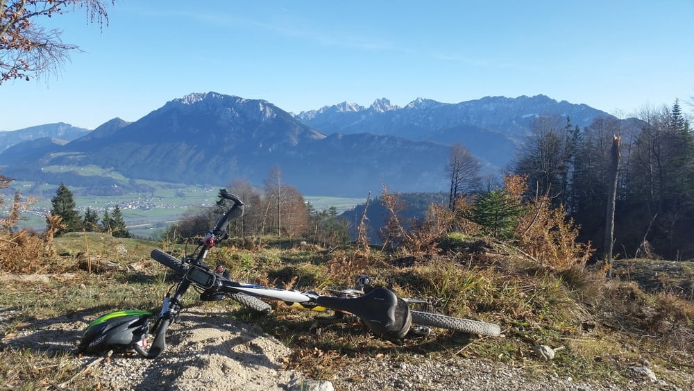
Kurze, knackige Runde mit sehr steiler Auffahrt im ersten Teil. An der Grenze der Fahrbarkeit. Super Blicke in den Kaiser und ins Inntal von der Ramsauerer Alm. Ab dort ein wilder Abfahrtstrial zum Zimmerau-Hof. Steil mit einigen blockigen Passagen, aber durchwegs fahrbar. Immer auf schmalen Pfad. Dann gehts wieder bergauf Richtung Ghf. Hockeck über urige Karrenwege, vorbei an alten Almen. Das letzte Stück ist wieder ein Waldpfadtrial, sehr spaßíg aber keine großen Anforderungen mehr.

Perfekte Tour für Trial Fans! Enstpricht Moser 22.


Galerie du tour

Carte du tour et altitude

  • Open Street Map
  • Google
Minimum height 614 m Maximum height 1092 m Vue de détail

More about the tour author

MikeHub82
Member since 2011

Send private message

Commentaires

Abfahrt Obderaudorf, dan nRichtung Kiefersfelden und schon kurz darauf zum Luegsteinsee abbiegen. Der Straße bergauf folgen (schmal) und hinauf in die Mühlau. An einer Verzwigung mit einer Bushaltestelle rechts halten und am Brünnstein Parkplatz parken. Großer Parkplatz, keine Gebühren.


Tracks GPS

Trackpoints
  • GPX / Garmin Map Source (gpx) download
  • TCX / Garmin Training Center® (tcx) download
  • CRS / Garmin Training Center® (crs) download
  • Google Earth (kml) download
  • G7ToWin (g7t) download
  • TTQV (trk) download
  • Overlay (ovl) download
  • Fugawi (txt) download
  • Kompass (DAV) Track (tk) download
  • Feuille de tours (pdf) download
  • Original file of the author (gpx) download

More about the tour author

MikeHub82
Member since 2011

Send private message
Share track
Add to my favorites
Remove from my favorites
Edit tags
My score
Rate
Tour: Von Oberaudorf rund ums Hocheck
Cat.: Mountainbike
Longueur: 12,8 km
Evaluated on:
Durée:
Day(s)
Hour(s)
Minute(s)
Evaluation: Paysage Aspect amusement Condition Technique