Login

Login oublié ?

Cookies have to be accepted!
Your browser's cookie functionality is disabled. Please enable this functionality.

Not a member yet?

Register now
Login

Available for registred users only

Log in to use this feature.

Login oublié ?

Cookies have to be accepted!
Your browser's cookie functionality is disabled. Please enable this functionality.

Not a member yet?

Register now
Filter
Catégories
Advanced filters
  • Longueur (km)
  • Altimètre
Enregistrer le filtre Reset filter

TrackRank

QRCode

Technical data

Longueur38,1 km Altimètre957 m Way down960 m Durée03:54 h:m Date18.01.2015
Evaluations Author Paysage Aspect amusement Condition Technique

Statistiques

695 Vues Evaluations 81 Téléchargements Moyenne
Rate
  • Feuille de tours
  • Arrivée
  • Téléchargements

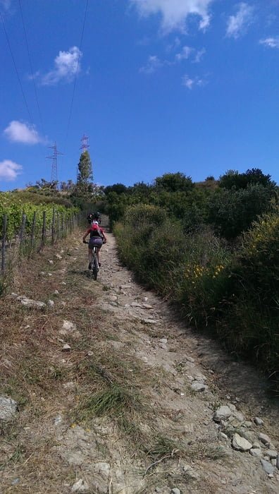
Diese gemütlich gefahrene Rundtour führte uns von Rodi aus über (Schotter-) Wege (2 steile!) und Straßen durch diverse Orte der Region.

Hinter dem Ort San Paolo ging es über die SP80 erst langsam und später über Serpentinen aufwärts auf die Maximalhöhe von 549 HM.

Kurz hinter dem Ort Santa Nicola wurde die Straße zu einem Schotterweg mit einigen kurzen An- und Abstiegen, um dann in Richtung des Ortes Gurafi Alto und weiter Porticato teils mit Trailqualitäten abwärts und nochmal kurz aufwärts zu führen. Auf dieser Wegstrecke kamen wir am Parco Jalari vorbei. Leider war er geschlossen, ist aber ein Tipp.

Der letzte Aufstieg vom trockenen Flussbett bis nach Borgo al Costa ging dann nochmal richtig in die Beine.


Further information at

http://ferienhaussizilien.de/

Galerie du tour

Carte du tour et altitude

  • Open Street Map
  • Google
Minimum height 79 m Maximum height 549 m Vue de détail

More about the tour author

RobbiTob
Member since 2009

Send private message

Commentaires

Die Tour startet direkt im Ort Rodi von der Ferienhausanlage Borgo al Costa.


Tracks GPS

Trackpoints
  • GPX / Garmin Map Source (gpx) download
  • TCX / Garmin Training Center® (tcx) download
  • CRS / Garmin Training Center® (crs) download
  • Google Earth (kml) download
  • G7ToWin (g7t) download
  • TTQV (trk) download
  • Overlay (ovl) download
  • Fugawi (txt) download
  • Kompass (DAV) Track (tk) download
  • Feuille de tours (pdf) download
  • Original file of the author (gpx) download

More about the tour author

RobbiTob
Member since 2009

Send private message
Share track
Add to my favorites
Remove from my favorites
Edit tags
My score
Rate
Tour: Rundtour Rodi - Acquaficara - San Paolo - Santa Nicola - Pizzo Soglio - Parco Jalari - Gurafi - Rodi
Cat.: Mountainbike
Longueur: 38,1 km
Evaluated on:
Durée:
Day(s)
Hour(s)
Minute(s)
Evaluation: Paysage Aspect amusement Condition Technique