


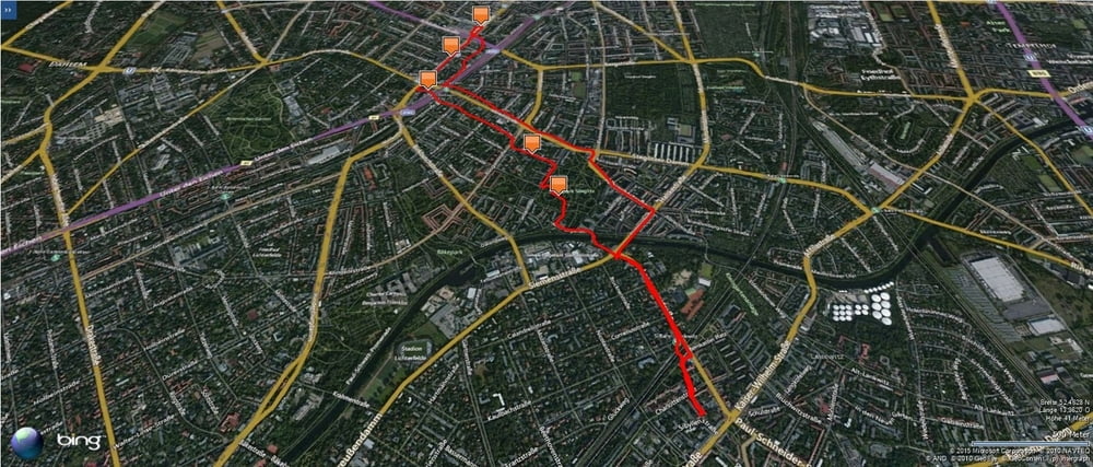
Am S-Bahnhof Lankwitz vorbei die Leonorenstraße entlang.
Danach durch den Stadtpark Lankwitz und durch die Beymestraße und Mittelstraße zum S-Bahnhof Rathaus Steglitz.
Wir erreichten zuerst den Globetrotter um danach noch bei Sport Scheck und in der größten Mall in der Schloßstraße vorbeizuschauen.
Den Rückweg nahmen wir dann auf der Straße.
Danach durch den Stadtpark Lankwitz und durch die Beymestraße und Mittelstraße zum S-Bahnhof Rathaus Steglitz.
Wir erreichten zuerst den Globetrotter um danach noch bei Sport Scheck und in der größten Mall in der Schloßstraße vorbeizuschauen.
Den Rückweg nahmen wir dann auf der Straße.
Further information at
https://de.wikipedia.org/wiki/Berlin-SteglitzGalerie du tour
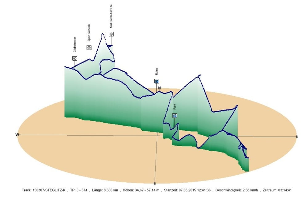
Carte du tour et altitude
Minimum height 37 m
Maximum height 57 m
More about the tour author
|
|
Pheinz |
Commentaires

Los geht es bei der Lankwitz Kirche.
Tracks GPS
Trackpoints-
GPX / Garmin Map Source (gpx) download
-
TCX / Garmin Training Center® (tcx) download
-
CRS / Garmin Training Center® (crs) download
-
Google Earth (kml) download
-
G7ToWin (g7t) download
-
TTQV (trk) download
-
Overlay (ovl) download
-
Fugawi (txt) download
-
Kompass (DAV) Track (tk) download
-
Feuille de tours (pdf) download
-
Original file of the author (gpx) download
More about the tour author
|
|
Pheinz |
Add to my favorites
Remove from my favorites
Edit tags
Open track
My score
Rate