Wie alle meine Touren, höchst mögliche Asphaltvermeidung....
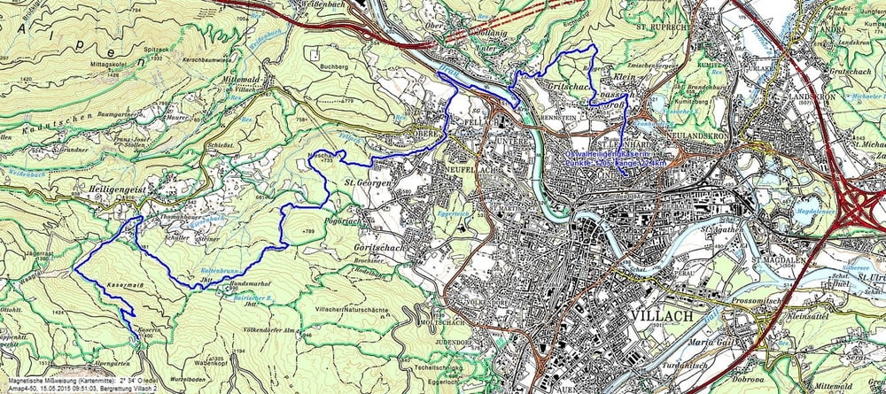
Die Tour führt über einen Teil des Oswaldiberges (Trailabfahrt in den Aichholzgraben) über die Drau - Staumauer in die obere Fellach - Kneipp Wiese - St. Georgen - Variante (steil) auf den Hundsmarhof und über Heiligengeist auf die Kaserin...
Dort hat mich das schlechte Wetter eingeholt, und ich musste abbrechen.
Die Abfahrt wäre vielfältig, und ist über andere Touren zur Genüge beschrieben...
Carte du tour et altitude
Minimum height 494 m
Maximum height 1409 m
Commentaires

Start ist in Villach Lind / Treffner Straße
Tracks GPS
Trackpoints-
GPX / Garmin Map Source (gpx) download
-
TCX / Garmin Training Center® (tcx) download
-
CRS / Garmin Training Center® (crs) download
-
Google Earth (kml) download
-
G7ToWin (g7t) download
-
TTQV (trk) download
-
Overlay (ovl) download
-
Fugawi (txt) download
-
Kompass (DAV) Track (tk) download
-
Feuille de tours (pdf) download
-
Original file of the author (gpx) download
Add to my favorites
Remove from my favorites
Edit tags
Open track
My score
Rate

