


Die Alpe Nenziger Himmel liegt auf circa 1370 m Höhe. Sie ist nur über eine private, der Gemeinde gehörende Mautstraße (Entfernung vom Bahnhof Nenzig ca. 13 km) erreichbar. Sie darf nur von Gemeindeeinwohner genutzt werden. Radfahrer sind auch verboten, Wanderer aber nicht.
Am besten bucht man am Vortag den Wanderbus, der einen vom Bahnhof Nenzig abholt und etwa 45 Minuten über die kurvenreiche Straße zum Ausgangspunkt bringt.
Telefon +43 5525 62 594
Die An- und Rückfahrt kostete im Juni 2015 € 18.
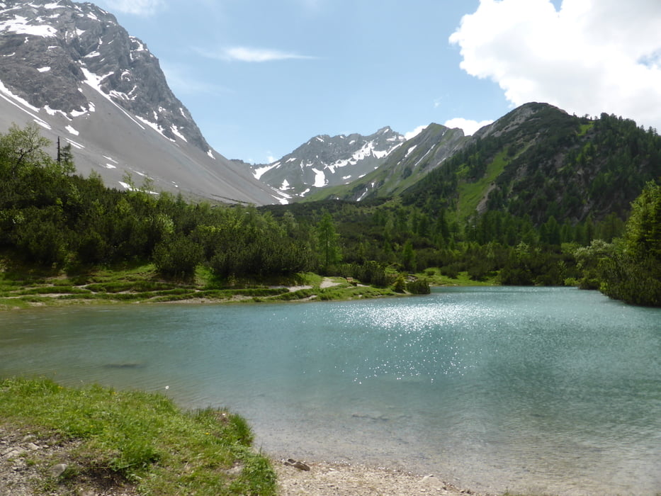
Vom Alpengasthof Gamperdona steigen wir hoch zur Setschalple und danach ab zum Hirschsee und zurück zum Ausgangspunkt
Further information at
http://www.vorarlberg.com/sommer/walgau-bludenz/nenzing-gurtis/wandern/nenzinger-himmel/hirschsee-alpe-gamperdona-amatschonjochGalerie du tour


Carte du tour et altitude
Minimum height 1361 m
Maximum height 1757 m
More about the tour author
|
|
horst1508 |
Commentaires

Der Bahnof Nenzing ist in etwa 1 Stunde aus von Bregenz erreichbar
Tracks GPS
Trackpoints-
GPX / Garmin Map Source (gpx) download
-
TCX / Garmin Training Center® (tcx) download
-
CRS / Garmin Training Center® (crs) download
-
Google Earth (kml) download
-
G7ToWin (g7t) download
-
TTQV (trk) download
-
Overlay (ovl) download
-
Fugawi (txt) download
-
Kompass (DAV) Track (tk) download
-
Feuille de tours (pdf) download
-
Original file of the author (gpx) download
More about the tour author
|
|
horst1508 |
Add to my favorites
Remove from my favorites
Edit tags
Open track
My score
Rate