


This was my favourite trek in South America, well maybe apart from the Cordillera Huayhuash in Peru anyway. Spectacular scenery, we had wonderful weather, and the refuges were a cut above anything else in South America. We did the whole thing through an agency as we were just on holiday in Chile but you don't need a guide so if you are already in SA and have all the equipment with you (ie: if you're backpacking) I think you could easily do it yourself.
We did this W trek as a 5-day hike, but I think you can also do a complete loop aroudn the northern edge of the National Park if you have the time - I think 7 days?
Further information at
http://www.realworldholidays.co.uk/chile/Galerie du tour


Carte du tour et altitude
Minimum height 99999 m
Maximum height -99999 m
More about the tour author

|
anna-gm |
Commentaires

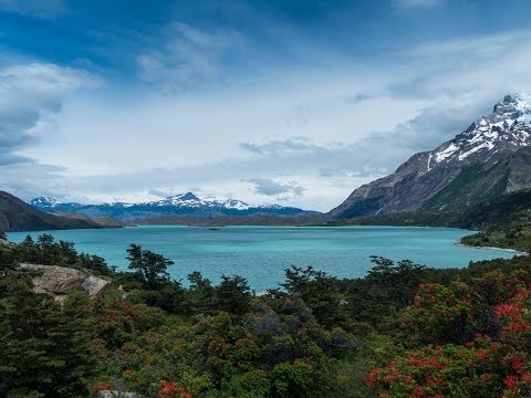
The tour starts at the Vertice Refugio and you then walk north along the shores of Lago Grey until you reach the Refugio Lago Grey where you stay tonight. From here you can head north another 1km to the foot of the Grey glacier before retracing your steps to the Refugio.
On Day 2 you trek back south to the Vertice Refugio and then head east to the north of Lake Skottsborg before cutting east across to the Rio Frances and the Campamento Italiano, where you stay tonight.
On Day 3 you follow the eastern bank of the Rio Frances north along the valley until you get to the Mirador at the northern end of the valley. From here you then head back down the valley to the campsite and then follow the shore of Lake Nordenskjold east until you get to the Los cuernos refugio. This is the longest day of the trek by far (around 10 hours) and is a real schlep but arguably the most spectacular of the trek as well.
On day 4 you have a long but level hike east from Los Cuernos until you reach the base of the Ascencio valley, just across from the Las Torres hotel. You follow the river north until you reach Lago Torres, where there are several campsites on the north shore.
On Day 5 all that's left to do is walk back down the valley to Las Torres, from where the bus will take you back to Puerto Natales and the ocean!
Tracks GPS
Trackpoints-
GPX / Garmin Map Source (gpx) download
-
TCX / Garmin Training Center® (tcx) download
-
CRS / Garmin Training Center® (crs) download
-
Google Earth (kml) download
-
G7ToWin (g7t) download
-
TTQV (trk) download
-
Overlay (ovl) download
-
Fugawi (txt) download
-
Kompass (DAV) Track (tk) download
-
Feuille de tours (pdf) download
-
Original file of the author (gpx) download
More about the tour author
|
|
anna-gm |
Add to my favorites
Remove from my favorites
Edit tags
Open track
My score
Rate