


Tourendatum: 20.08.2015
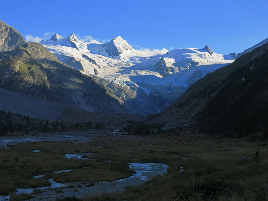
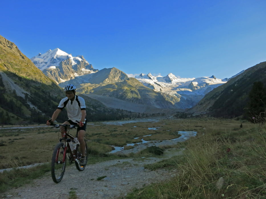
Tourencharakter: Einfache, flache Aufwärmtour in ein landschaftlich sehr schönes Seitental nahe Pontresina. Untertags viele Besucher, die z.T. auch mit Pferdekutschen ins Tal befördert werden. Ab Spätnachmittag ruhig. Sehr schöne Ausblicke auf die Gletscherberge am Talende.
Tourenverlauf: Vom Campingplatz Morteratsch (ca. 1870) zur Bahnstation Morteratsch, dort über den Bach auf die andere Talseite. Auf dem schönen Sandweg immer den Radwegweisern Richtung Pontresina folgen. Man erreicht nach meist flacher Talfahrt den Taleingang ins Rosegtal nahe Pontresina (ca.1780).
Auf der sehr gut ausgebauten Sandstraße gehts immer angenehm flach taleinwärts dem Bach entlang. Mit der Zeit tauchen die Gletscher am Talende auf, man fährt in wildromantischer Umgebung mühelos zum Ghs. Roseg (1999). Von da führt ein Karrenweg weiter taleinwärts bis zur Alp Ota Suot (2022), wo die Tour endet.
Ab-/Rückfahrt wie Anfahrt.
Galerie du tour


Carte du tour et altitude
Minimum height 1775 m
Maximum height 2038 m
More about the tour author
|
|
Eimy |
Commentaires

Oberengadin - Richtung Pontresina/Berninapass - am Taleingang zum Rosegtal Parkmöglichkeiten
Tracks GPS
Trackpoints-
GPX / Garmin Map Source (gpx) download
-
TCX / Garmin Training Center® (tcx) download
-
CRS / Garmin Training Center® (crs) download
-
Google Earth (kml) download
-
G7ToWin (g7t) download
-
TTQV (trk) download
-
Overlay (ovl) download
-
Fugawi (txt) download
-
Kompass (DAV) Track (tk) download
-
Feuille de tours (pdf) download
-
Original file of the author (gpx) download
More about the tour author
|
|
Eimy |
Add to my favorites
Remove from my favorites
Edit tags
Open track
My score
Rate