


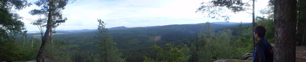
Die Tour bewegt sich auf angenehm ruhigen, ja beinahe einsamen Strecken in der Sächsischen Schweiz und bietet ab und an ein herrliches Panorama.
Gestartet sind wir auf dem ehemaligen Parkplatz einer verfallenen Gaststätte in Rosenthal. Für den offiziellen Parkplatz mitten in der Pampa auf der Grenzstraße müsste man 3 Euro berappen.
Einkehren kann man unterwegs in der Katzsteinbaude, sich abkühlen im Fuchsteich oder im Cunnersdorfer Waldbad.
Gestartet sind wir auf dem ehemaligen Parkplatz einer verfallenen Gaststätte in Rosenthal. Für den offiziellen Parkplatz mitten in der Pampa auf der Grenzstraße müsste man 3 Euro berappen.
Einkehren kann man unterwegs in der Katzsteinbaude, sich abkühlen im Fuchsteich oder im Cunnersdorfer Waldbad.
Further information at
http://www.freiberg-service.de/Galerie du tour


Carte du tour et altitude
Minimum height 272 m
Maximum height 528 m
More about the tour author
|
|
Saxoniaradler |
Commentaires

Von Freiberg geht es auf der A17 an Dresden vorbei in die Sächsische Schweiz. Camper können von ihrem Platz am Waldbad ebenso nach ein paar hundert Metern auf die B101 auffahren.
Tracks GPS
Trackpoints-
GPX / Garmin Map Source (gpx) download
-
TCX / Garmin Training Center® (tcx) download
-
CRS / Garmin Training Center® (crs) download
-
Google Earth (kml) download
-
G7ToWin (g7t) download
-
TTQV (trk) download
-
Overlay (ovl) download
-
Fugawi (txt) download
-
Kompass (DAV) Track (tk) download
-
Feuille de tours (pdf) download
-
Original file of the author (gpx) download
More about the tour author
|
|
Saxoniaradler |
Add to my favorites
Remove from my favorites
Edit tags
Open track
My score
Rate