


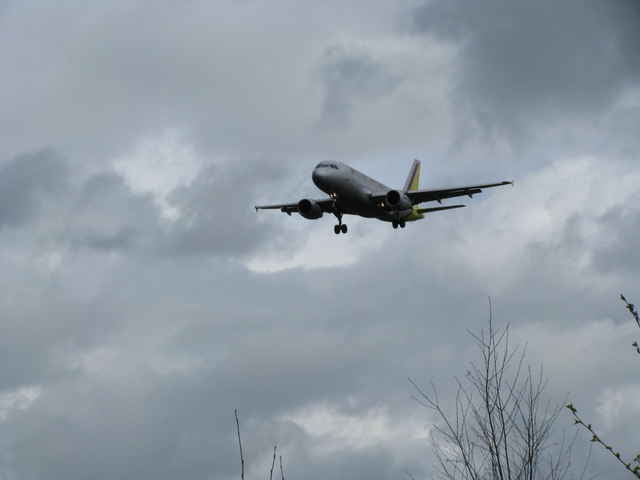
Wer den Köln/Bonner Flughafen mal von einer etwas anderen Seite kennenlernen will, ist bei dieser Wanderung genau richtig. Auf halber Strecke gelangt man bis kurz vor den Zaun des Flughafengeländes und wandert von dort entlang einer Landeanflugbahn wieder zurück. Mit etwas Glück kann man im Landeanflug befindliche Flugzeuge aus nächster Nähe bewundern. Ansonsten hat man auch einen hervorragenden Blick auf die stark genutzte Startbahn.
Definitiv eine etwas andere Wanderung. Und wer nun gar nicht auf die Kombination Technik und Natur steht, sollte sich diese Tour wohl besser schenken.
Definitiv eine etwas andere Wanderung. Und wer nun gar nicht auf die Kombination Technik und Natur steht, sollte sich diese Tour wohl besser schenken.
Galerie du tour
Carte du tour et altitude
Minimum height 84 m
Maximum height 116 m
More about the tour author

|
Commentaires

Rösrath-Scharrenbroich am Strassenrand direkt vor der Fußgängerbrücke über die A3
Tracks GPS
Trackpoints-
GPX / Garmin Map Source (gpx) download
-
TCX / Garmin Training Center® (tcx) download
-
CRS / Garmin Training Center® (crs) download
-
Google Earth (kml) download
-
G7ToWin (g7t) download
-
TTQV (trk) download
-
Overlay (ovl) download
-
Fugawi (txt) download
-
Kompass (DAV) Track (tk) download
-
Feuille de tours (pdf) download
-
Original file of the author (g7t) download
More about the tour author
|
|
Add to my favorites
Remove from my favorites
Edit tags
Open track
My score
Rate