Login

Login oublié ?

Cookies have to be accepted!
Your browser's cookie functionality is disabled. Please enable this functionality.

Not a member yet?

Register now
Login

Available for registred users only

Log in to use this feature.

Login oublié ?

Cookies have to be accepted!
Your browser's cookie functionality is disabled. Please enable this functionality.

Not a member yet?

Register now
Filter
Catégories
Advanced filters
  • Longueur (km)
  • Altimètre
Enregistrer le filtre Reset filter

TrackRank

QRCode

Technical data

Longueur41,1 km Altimètre615 m Way down609 m Durée02:30 h:m Date12.11.2015
Evaluations Author Paysage Aspect amusement Condition Technique

Statistiques

549 Vues Evaluations 64 Téléchargements Moyenne
Rate
  • Feuille de tours
  • Arrivée
  • Téléchargements

Von Ratzenried über Neumühle und dann Arrisried ins Kisslegger Hinterland.

Verschiedene Einkehr und Pausengelegenheiten an der Strecke.

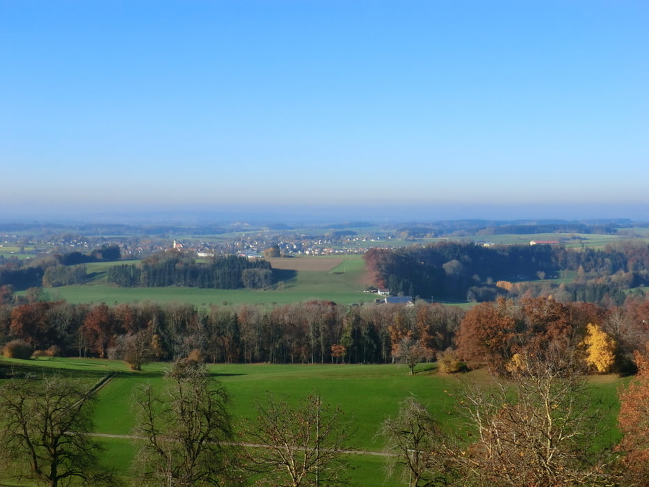
Die Süh ist ein schöner Aussichtspunkt  zu beiden Seiten -- nach Süden die Nagelfluhkette, nach Nord-West im Vorderfeld Bergatreute, dahinter Aulendorf,...

Schöne Runde mit ein parr wenigen mittelschweren Passagen, sonst leicht.


Galerie du tour

Carte du tour et altitude

  • Open Street Map
  • Google
Minimum height 600 m Maximum height 742 m Vue de détail

More about the tour author

urgesimi
Member since 2009

Send private message

Commentaires

Tracks GPS

Trackpoints
  • GPX / Garmin Map Source (gpx) download
  • TCX / Garmin Training Center® (tcx) download
  • CRS / Garmin Training Center® (crs) download
  • Google Earth (kml) download
  • G7ToWin (g7t) download
  • TTQV (trk) download
  • Overlay (ovl) download
  • Fugawi (txt) download
  • Kompass (DAV) Track (tk) download
  • Feuille de tours (pdf) download
  • Original file of the author (gpx) download

More about the tour author

urgesimi
Member since 2009

Send private message
Share track
Add to my favorites
Remove from my favorites
Edit tags
My score
Rate
Tour: Ratzenried nach Süh-Wolfegg Rundkurs
Cat.: Mountainbike
Longueur: 41,1 km
Evaluated on:
Durée:
Day(s)
Hour(s)
Minute(s)
Evaluation: Paysage Aspect amusement Condition Technique