
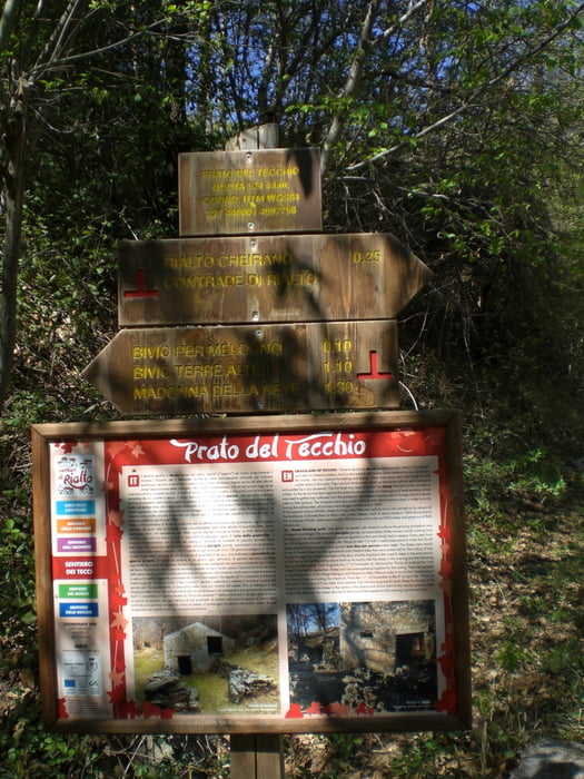

vom Camping Tahiti über Orco Feligno auf Asphalt (ca. 400 hm) nach Costa. Kurz vor Costa links ab zum Colle de San Giacomo (Fahrweg). Beim Refugio geht es steil hoch Richtung Pian dei Corsi (ab hier sind einige Stücke drin, wo ich das Bike schieben mußte). Wir fahren den Cravarezza-Trail zur Nato-Base hoch. Kurz den Sentiero H hinunter. Dann leider die Strasse hinauf zur Kapelle Madonna della Neve. Hier dem AV-Weg folgen. Achtung Trail geht links ab, sehr unscheinbar. Schöner erdiger Trail. Dann habe ich mich vermutlich verfahren, denn der Weg ging sehr steil, sehr unaufgeräumt bergab. Nachher mußte ich wieder ca. 200 hm hochtreten, um auf den AV-Weg wieder zu kommen. Irgendwann geht es dann rechts in den Tecchiotrail rein, der hinunter bis Calvi geht. Er ist fahrbar, aber es liegt cm-hoch Laub drin, das Äste und Steine verdeckt. Alles sehr spannend und teilweise sehr steil. Ab Calvi auf der Strasse zurück zum Camping.
Galerie du tour

Carte du tour et altitude
Minimum height -64 m
Maximum height 1018 m
More about the tour author
|
|
Fruehaufsteher |
Commentaires

Tracks GPS
Trackpoints-
GPX / Garmin Map Source (gpx) download
-
TCX / Garmin Training Center® (tcx) download
-
CRS / Garmin Training Center® (crs) download
-
Google Earth (kml) download
-
G7ToWin (g7t) download
-
TTQV (trk) download
-
Overlay (ovl) download
-
Fugawi (txt) download
-
Kompass (DAV) Track (tk) download
-
Feuille de tours (pdf) download
-
Original file of the author (gpx) download
More about the tour author
|
|
Fruehaufsteher |
Add to my favorites
Remove from my favorites
Edit tags
Open track
My score
Rate