Login

Login oublié ?

Cookies have to be accepted!
Your browser's cookie functionality is disabled. Please enable this functionality.

Not a member yet?

Register now
Login

Available for registred users only

Log in to use this feature.

Login oublié ?

Cookies have to be accepted!
Your browser's cookie functionality is disabled. Please enable this functionality.

Not a member yet?

Register now
Filter
Catégories
Advanced filters
  • Longueur (km)
  • Altimètre
Enregistrer le filtre Reset filter

TrackRank

QRCode

Technical data

Longueur49,2 km Altimètre1094 m Way down1078 m Durée03:06 h:m Date19.06.2016
Evaluations Author Paysage Aspect amusement Condition Technique

Statistiques

295 Vues Evaluations 40 Téléchargements Moyenne
Rate
  • Feuille de tours
  • Arrivée
  • Téléchargements

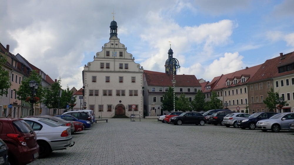
von dresden über goldene höhe zur maltertalsperre und dippoldiswalde. über elend und niederfrauendorf nach reinhardsgrimma. über den willisch nach kreischa und über babisnau, gaustritz und goppeln zurück.


Galerie du tour

Carte du tour et altitude

  • Open Street Map
  • Google
Minimum height 104 m Maximum height 459 m Vue de détail

More about the tour author

chris_dd
Member since 2011

Send private message

Commentaires

Tracks GPS

Trackpoints
  • GPX / Garmin Map Source (gpx) download
  • TCX / Garmin Training Center® (tcx) download
  • CRS / Garmin Training Center® (crs) download
  • Google Earth (kml) download
  • G7ToWin (g7t) download
  • TTQV (trk) download
  • Overlay (ovl) download
  • Fugawi (txt) download
  • Kompass (DAV) Track (tk) download
  • Feuille de tours (pdf) download
  • Original file of the author (gpx) download

More about the tour author

chris_dd
Member since 2011

Send private message
Share track
Add to my favorites
Remove from my favorites
Edit tags
My score
Rate
Tour: Dippoldiswalde
Cat.: Mountainbike
Longueur: 49,2 km
Evaluated on:
Durée:
Day(s)
Hour(s)
Minute(s)
Evaluation: Paysage Aspect amusement Condition Technique