


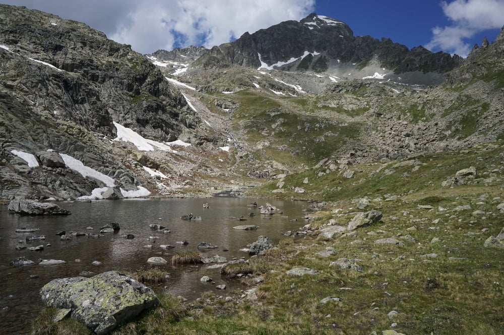
Eine sehr abgelegene einsame Bergtour zu einem Bergsee. Landschaftlich extrem reizvoll!
Der Wanderweg führt dem rauschenden Bergbach Ava da Mulix entlang. Zunächst ist der Weg ein gut sichtbarer Pfad, später benötigt man ein gutes Auge um im gerölldurchsetzten Gelände den nächsten rot-weissen Wegweiser zu sehen. Technisch gibt es keine grossen Herausforderungen.
Die Tour ist auch im Stil-Magazin der NZZ am Sonntag (7. September 2014) von Heinz Staffelbach empfohlen worden.
Galerie du tour


Carte du tour et altitude
Minimum height 1741 m
Maximum height 2663 m
More about the tour author
|
|
s-braeutigam |
Commentaires

Preda ist Haltepunkt der Rhätrischen Bahn.
Mit dem Auto findet man in dieser abgelegenen Region auch gute Möglichkeiten zum Parkieren.
Tracks GPS
Trackpoints-
GPX / Garmin Map Source (gpx) download
-
TCX / Garmin Training Center® (tcx) download
-
CRS / Garmin Training Center® (crs) download
-
Google Earth (kml) download
-
G7ToWin (g7t) download
-
TTQV (trk) download
-
Overlay (ovl) download
-
Fugawi (txt) download
-
Kompass (DAV) Track (tk) download
-
Feuille de tours (pdf) download
-
Original file of the author (gpx) download
More about the tour author
|
|
s-braeutigam |
Add to my favorites
Remove from my favorites
Edit tags
Open track
My score
Rate