Login

Login oublié ?

Cookies have to be accepted!
Your browser's cookie functionality is disabled. Please enable this functionality.

Not a member yet?

Register now
Login

Available for registred users only

Log in to use this feature.

Login oublié ?

Cookies have to be accepted!
Your browser's cookie functionality is disabled. Please enable this functionality.

Not a member yet?

Register now
Filter
Catégories
Advanced filters
  • Longueur (km)
  • Altimètre
Enregistrer le filtre Reset filter

TrackRank

QRCode

Technical data

Longueur38,3 km Altimètre1456 m Way down1447 m Durée00:00 h:m Date05.10.2016
Evaluations Author Paysage Aspect amusement Condition Technique

Statistiques

334 Vues Evaluations 73 Téléchargements Moyenne
Rate
  • Feuille de tours
  • Arrivée
  • Téléchargements
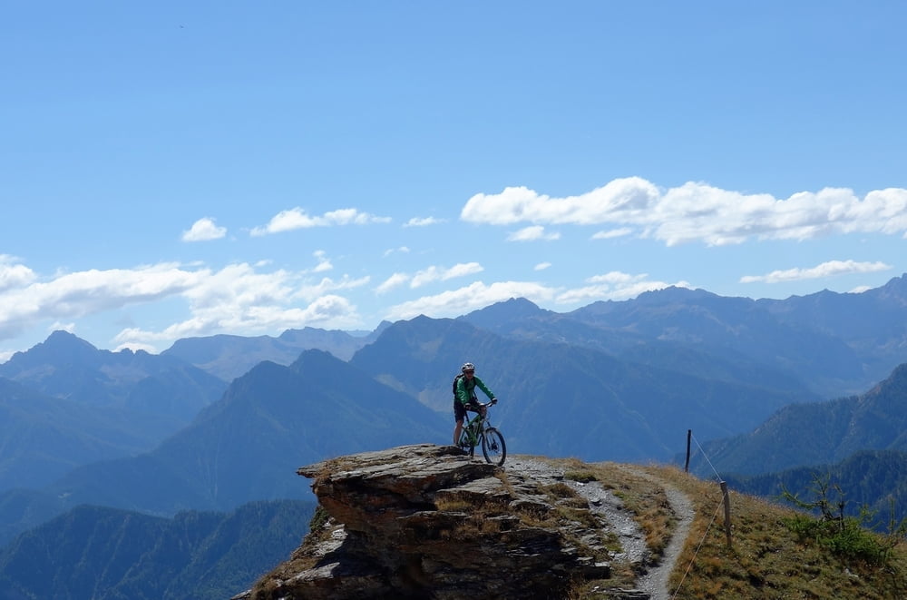
Sehr schöne Tour von Casteldelfino auf den Col Sampeyre über Almwege, dann ein Stück Passtrasse. Dann die alte Cannoni-Militärstraße ein Stück zurück und dann einen schönen Trail zurück. Sollte man mal fahren.

Galerie du tour

Carte du tour et altitude

  • Open Street Map
  • Google
Minimum height 1222 m Maximum height 2331 m Vue de détail

More about the tour author

haaaatz
Member since 2011

Send private message

Commentaires

Tracks GPS

Trackpoints
  • GPX / Garmin Map Source (gpx) download
  • TCX / Garmin Training Center® (tcx) download
  • CRS / Garmin Training Center® (crs) download
  • Google Earth (kml) download
  • G7ToWin (g7t) download
  • TTQV (trk) download
  • Overlay (ovl) download
  • Fugawi (txt) download
  • Kompass (DAV) Track (tk) download
  • Feuille de tours (pdf) download
  • Original file of the author (gpx) download

More about the tour author

haaaatz
Member since 2011

Send private message
Share track
Add to my favorites
Remove from my favorites
Edit tags
My score
Rate
Tour: Col Sampeyre und Strada Cannoni
Cat.: Mountainbike
Longueur: 38,3 km
Evaluated on:
Durée:
Day(s)
Hour(s)
Minute(s)
Evaluation: Paysage Aspect amusement Condition Technique