


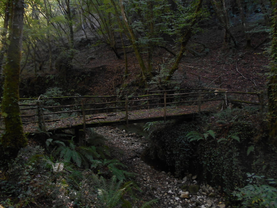
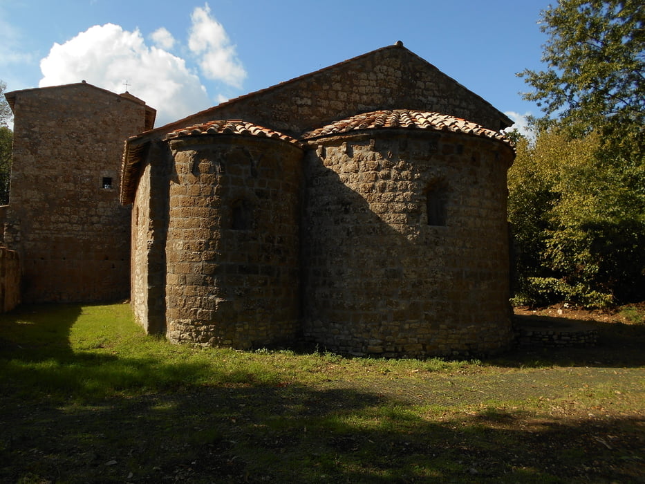
Bellissima uscita.Il programma era totalmente diverso, ma camminando e curiosando qua e la, è venuto fuori questo anello pieno di sorprese. Dal parcheggio di Barbarano Romano, sono sceso per una strada a gradoni non più frequentata fino al Fosso del Biedano che ho seguito per un po'. Arrivato alla Seconda Mola ho lasciato il Biedano per seguire il Fosso del Neme che praticamente senza segni conduce fino alla necropoli di S.Giuliano (basta seguire il torrente, ora a destra ora a sinistra, o camminando proprio nel letto, scegliete voi). Qui si cominciano a vedere segni e cartelli con indicazioni delle tombe più importanti. Seguendo le indicazioni si arriva al Tumulo della Cima per poi puntare verso Barbarano attraverando prima una tagliata etusca poi un ponte antico che sbuca in uno slargo dove è situato un fontanile molto bello. Siamo ai piedi di Barbarano,
Galerie du tour

Carte du tour et altitude
Minimum height 264 m
Maximum height 367 m
More about the tour author
|
|
Ozujsko |
Commentaires

Tracks GPS
Trackpoints-
GPX / Garmin Map Source (gpx) download
-
TCX / Garmin Training Center® (tcx) download
-
CRS / Garmin Training Center® (crs) download
-
Google Earth (kml) download
-
G7ToWin (g7t) download
-
TTQV (trk) download
-
Overlay (ovl) download
-
Fugawi (txt) download
-
Kompass (DAV) Track (tk) download
-
Feuille de tours (pdf) download
-
Original file of the author (gpx) download
More about the tour author
|
|
Ozujsko |
Add to my favorites
Remove from my favorites
Edit tags
Open track
My score
Rate