Login

Login oublié ?

Cookies have to be accepted!
Your browser's cookie functionality is disabled. Please enable this functionality.

Not a member yet?

Register now
Login

Available for registred users only

Log in to use this feature.

Login oublié ?

Cookies have to be accepted!
Your browser's cookie functionality is disabled. Please enable this functionality.

Not a member yet?

Register now
Filter
Catégories
Advanced filters
  • Longueur (km)
  • Altimètre
Enregistrer le filtre Reset filter

TrackRank

QRCode

Technical data

Longueur40,5 km Altimètre1429 m Way down1412 m Durée04:00 h:m Date07.12.2016
Evaluations Author Paysage Aspect amusement Condition Technique

Statistiques

743 Vues Evaluations 132 Téléchargements Moyenne
Rate
  • Feuille de tours
  • Arrivée
  • Téléchargements

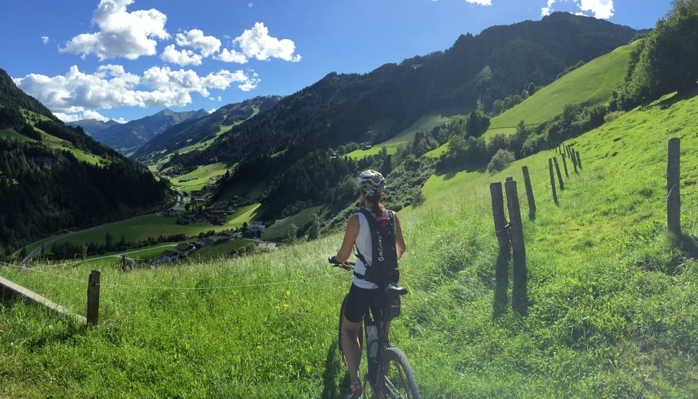
Ausgehend vom Ort Grossarl werden fünf der wesentlichen Hütten des Tales erreicht. Wenn man dem Track folgt geschieht das in folgender Reihenfolge: Maurachalm, Unterwandalm, Karsegg-Heimalm, Großwildalm und Saukaralm. Zwischen Großwild und Saukaralm besteht über etwa 1 km kein fahrbarer Untergrund, daher ist eine Schiebe- bzw. Tragepassage notwendig. Sie ist gut begehbar - allerdings nach langem Regen u. U. nicht empfehlenswert.

Von dieser Tragestrecke abgesehen besteht die gesamte Streckenführung auf einer Forststraße und anfangs auch auf asphaltiertem Untergrund. Die Highlights der Tour sind die schöne Landschaft, die eindrucksvollen Fernblick bietet und die Kulinarik einzelner Hütten.

Further information at

https://www.grossarltal.at/

Galerie du tour

Carte du tour et altitude

  • Open Street Map
  • Google
Minimum height 747 m Maximum height 1726 m Vue de détail

More about the tour author

FranzH
Member since 2009

Send private message

Commentaires

Das Großarltal ist über die Tauernautobahn Abfahrt Bischofshofen, St. Johann im Pongau, Zell am See leicht erreichbar. Von St. Johann i.P. ist den Hinweisschildern ins Grossarltal zu folgen. Der Ort Grossarl, der zugleich Ausgangspunkt der Tour ist, wird in 16 km erreicht.

Tracks GPS

Trackpoints
  • GPX / Garmin Map Source (gpx) download
  • TCX / Garmin Training Center® (tcx) download
  • CRS / Garmin Training Center® (crs) download
  • Google Earth (kml) download
  • G7ToWin (g7t) download
  • TTQV (trk) download
  • Overlay (ovl) download
  • Fugawi (txt) download
  • Kompass (DAV) Track (tk) download
  • Feuille de tours (pdf) download
  • Original file of the author (gpx) download

More about the tour author

FranzH
Member since 2009

Send private message
Share track
Add to my favorites
Remove from my favorites
Edit tags
My score
Rate
Tour: 5 Hütten Tour
Cat.: Mountainbike
Longueur: 40,5 km
Evaluated on:
Durée:
Day(s)
Hour(s)
Minute(s)
Evaluation: Paysage Aspect amusement Condition Technique