Login

Login oublié ?

Cookies have to be accepted!
Your browser's cookie functionality is disabled. Please enable this functionality.

Not a member yet?

Register now
Login

Available for registred users only

Log in to use this feature.

Login oublié ?

Cookies have to be accepted!
Your browser's cookie functionality is disabled. Please enable this functionality.

Not a member yet?

Register now
Filter
Catégories
Advanced filters
  • Longueur (km)
  • Altimètre
Enregistrer le filtre Reset filter

TrackRank

QRCode

Technical data

Longueur9,2 km Altimètre317 m Way down322 m Durée00:00 h:m Date26.02.2017
Evaluations Author Paysage Aspect amusement Condition Technique

Statistiques

278 Vues Evaluations 25 Téléchargements Moyenne
Rate
  • Feuille de tours
  • Arrivée
  • Téléchargements

Von Hausen, im Oberen Filstal geht's hoch durch den Wald zu den Felsformationen.
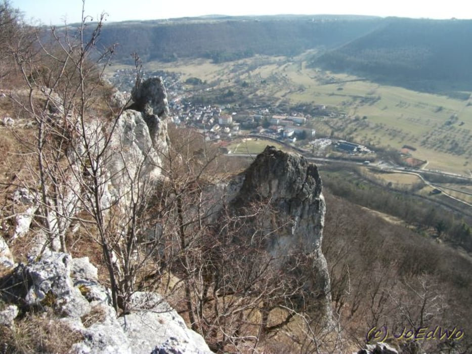
Grandiose Aussicht erwartet uns oben. Von einem Ausichtspunkt zum nächsten....
Abstieg Richtung Bad Überkingen und dann durch den Wald zurück nach Hausen


Galerie du tour

Carte du tour et altitude

  • Open Street Map
  • Google
Minimum height 511 m Maximum height 793 m Vue de détail

More about the tour author

Salomon
Member since 2009

Send private message

Commentaires

Tracks GPS

Trackpoints
  • GPX / Garmin Map Source (gpx) download
  • TCX / Garmin Training Center® (tcx) download
  • CRS / Garmin Training Center® (crs) download
  • Google Earth (kml) download
  • G7ToWin (g7t) download
  • TTQV (trk) download
  • Overlay (ovl) download
  • Fugawi (txt) download
  • Kompass (DAV) Track (tk) download
  • Feuille de tours (pdf) download
  • Original file of the author (gpx) download

More about the tour author

Salomon
Member since 2009

Send private message
Share track
Add to my favorites
Remove from my favorites
Edit tags
My score
Rate
Tour: Hausener FelsTour
Cat.: Randonnées
Longueur: 9,2 km
Evaluated on:
Durée:
Day(s)
Hour(s)
Minute(s)
Evaluation: Paysage Aspect amusement Condition Technique