


Nette Wanderung mit Halt an einem tollen Schorchelstrand. Im Nachinein mit Oruxmaps erstellt, deswegen kein Höhenprofil.
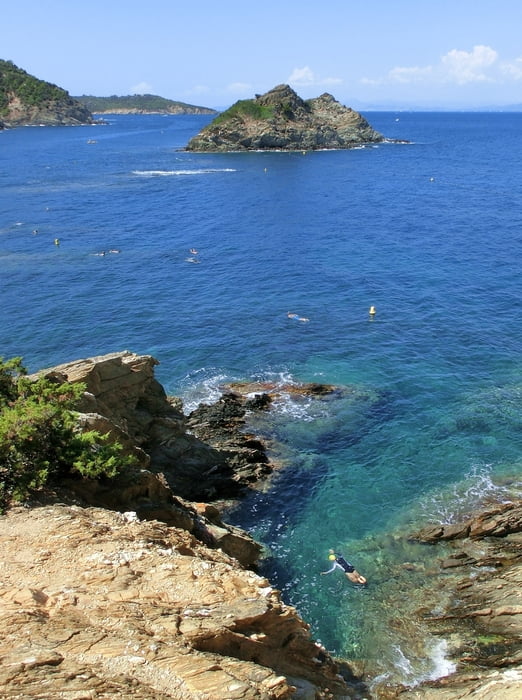
Start Port-Cros Hafen (WPT_76). Bei WPT_77 bin ich mir nicht sicher, ob wir den linken oder rechten Weg hinunter zum Schorchelstrand La Palud (WPT_79) genommen haben, bleibt sich gleich. In der Bucht war es ziemlich voll um die Mittagszeit (August). Unter Wasser befindet sich ein Lehrpfad, d.h. Bojen weisen ein bisschen den Weg und daran befindliche Karten zeigen die zu sichtenden Fische und deren Namen. Also prima für Kinder geeignet. Über die Pointe de la Galere (WPT_81) ging es an die Ostseite zum kleinen "Hafen" Port-Man (WPT_82), später über Inland zurück nach Port-Cros. Bei enstprechender Zeit lohnt es sich vielleicht doch, die gesamte Rother Tour, zu gehen und die Insel komplett zu umrunden (17,5 km). Einkehrmöglichkeiten habe ich nur in Port-Cros Hafen gesehen.
Galerie du tour


Carte du tour et altitude
Minimum height 99999 m
Maximum height -99999 m
More about the tour author
|
|
mackator |
Commentaires

Port-Cros Hafen
Tracks GPS
Trackpoints-
GPX / Garmin Map Source (gpx) download
-
TCX / Garmin Training Center® (tcx) download
-
CRS / Garmin Training Center® (crs) download
-
Google Earth (kml) download
-
G7ToWin (g7t) download
-
TTQV (trk) download
-
Overlay (ovl) download
-
Fugawi (txt) download
-
Kompass (DAV) Track (tk) download
-
Feuille de tours (pdf) download
-
Original file of the author (gpx) download
More about the tour author
|
|
mackator |
Add to my favorites
Remove from my favorites
Edit tags
Open track
My score
Rate