


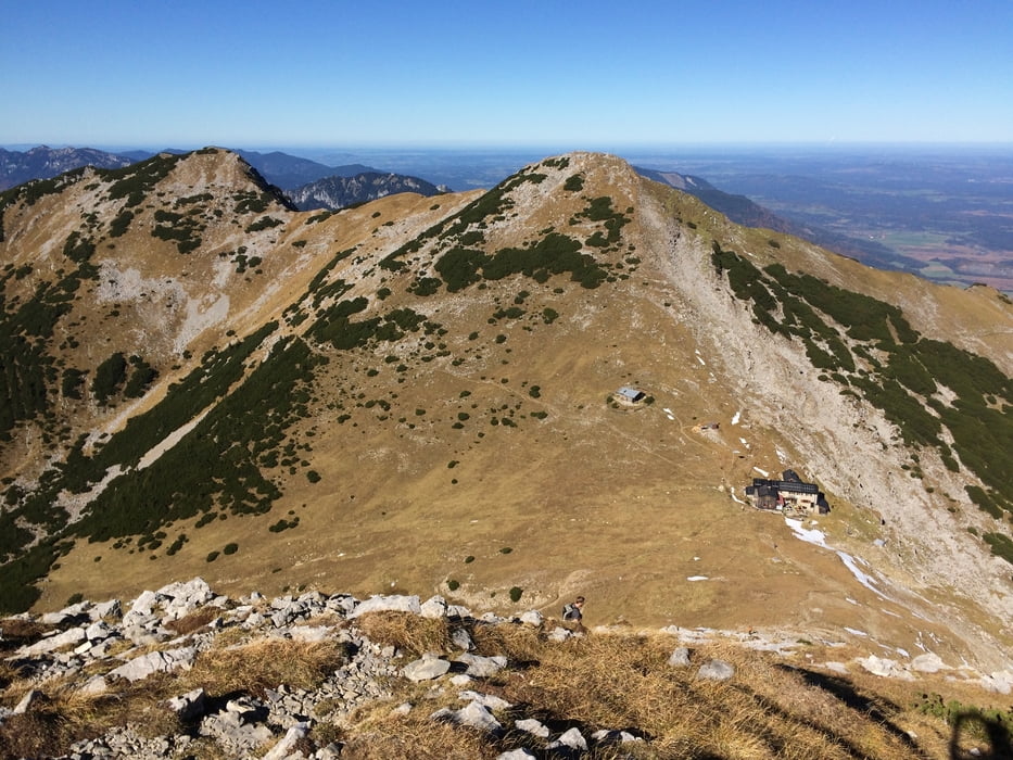
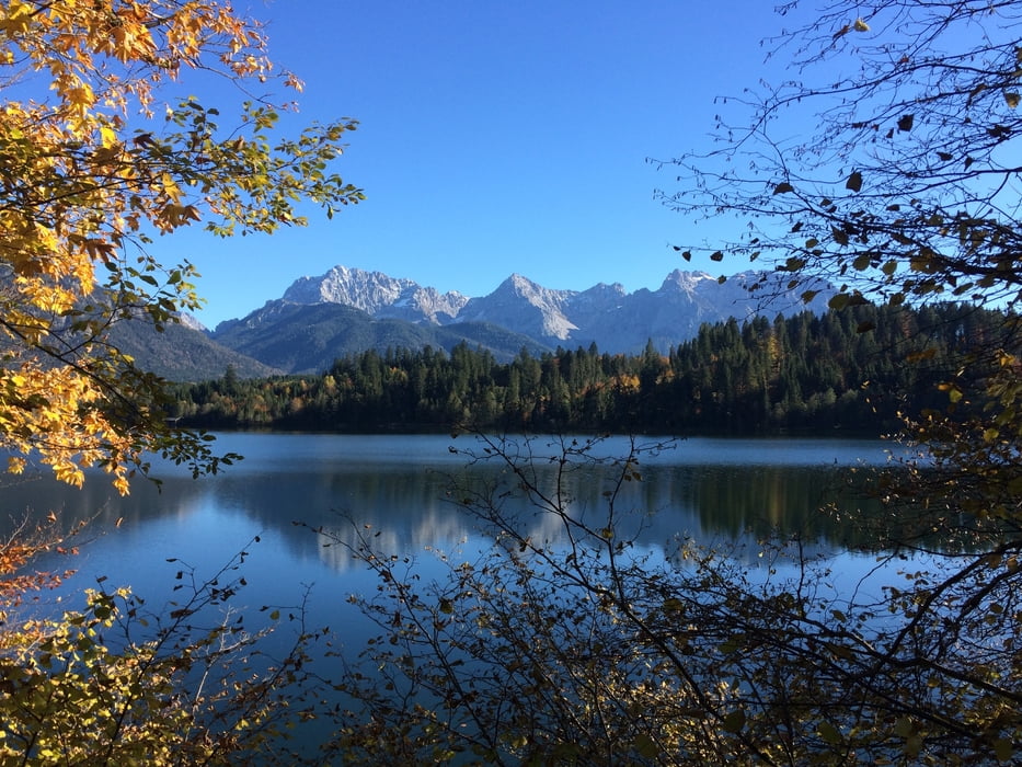
Lange Durchquerung des Estergebirges mit Super-Panorama am Krottenkopf. Weitere Highlights waren die friedliche Esterbergalm im dampfenden Morgentau, die latschengesäumte Karstlandschaft des Michelfelds, tolle Ausblicke auf die bayerischen Seen, der Abstieg zur Krüner Alm an den gerölligen Steilhängen des Klaffen, ein weiteres Traumpanorama an der Krüner Alm, der schöne Weg entlang des Altgrabens, die kühl-romantische Finzbachklamm,sowie der Barmsee mit Karwendelblick...
Kurz gesagt: Man bekommt für die Strapazen einiges geboten.
Mit dem Zug kann man von Klais in ca. 25 Minuten zum Ausgangspunkt zurückfahren (Parkplatz am Bahnhof Farchant).
Galerie du tour


Carte du tour et altitude
Minimum height 670 m
Maximum height 2059 m
More about the tour author
|
|
m-tier |
Commentaires

Mit Auto oder Bahn nach Farchant.
Tracks GPS
Trackpoints-
GPX / Garmin Map Source (gpx) download
-
TCX / Garmin Training Center® (tcx) download
-
CRS / Garmin Training Center® (crs) download
-
Google Earth (kml) download
-
G7ToWin (g7t) download
-
TTQV (trk) download
-
Overlay (ovl) download
-
Fugawi (txt) download
-
Kompass (DAV) Track (tk) download
-
Feuille de tours (pdf) download
-
Original file of the author (gpx) download
More about the tour author
|
|
m-tier |
Add to my favorites
Remove from my favorites
Edit tags
Open track
My score
Rate