

vom Hwy zum Cassidy Trail.
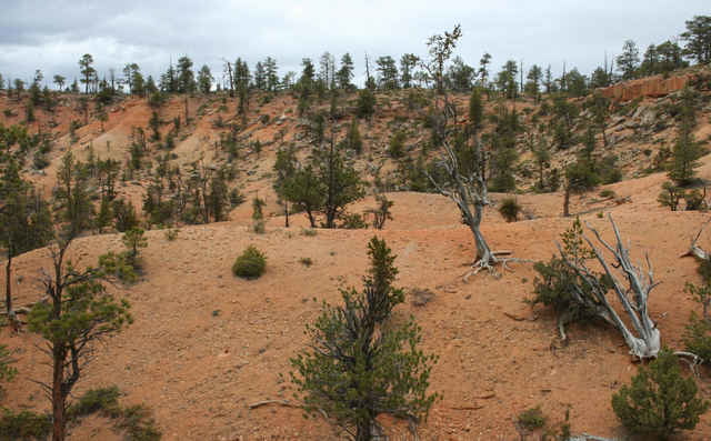
Zusammen mit den Trails Thunder Mountain / Casto und Losee gibt das eine tolle Runde mit Traum - Aussichten und Landschaften.
Zusammen mit den Trails Thunder Mountain / Casto und Losee gibt das eine tolle Runde mit Traum - Aussichten und Landschaften.
Carte du tour et altitude
Minimum height 2234 m
Maximum height 2421 m
More about the tour author
|
|
RandB |
Commentaires
Von Panguitch einfach Richtung Bryce Canyon fahren.
Am Eingang zum Red Canyon ist rechts ein Parkplatz.
Der eignet sich als Startpunkt für Thunder Mountain und Cassidy.
Ein Sück weiter in den Canyon rein gibt es einen State - Park. Der war allerdings bis auf den letzten Platz belegt, als wir um ca. 16:00 dort nachgeschaut haben.
In Panguitch gibt es einen KOA - Camp.
Tracks GPS
Trackpoints-
GPX / Garmin Map Source (gpx) download
-
TCX / Garmin Training Center® (tcx) download
-
CRS / Garmin Training Center® (crs) download
-
Google Earth (kml) download
-
G7ToWin (g7t) download
-
TTQV (trk) download
-
Overlay (ovl) download
-
Fugawi (txt) download
-
Kompass (DAV) Track (tk) download
-
Feuille de tours (pdf) download
-
Original file of the author (gpx) download
More about the tour author
|
|
RandB |
Add to my favorites
Remove from my favorites
Edit tags
Open track
My score
Rate
Cassidy
meine Tipps für andere: Neben dem Highway verläuft ein schöner neuer Radweg (2008). Die Tour von RandB endete bei mir mitten auf dem trail, aber kein Problem, einfach weiterfahren bis Weggabelung mit Schildern. ich bin dann den Losee runter- fantastische Kulisse, unbedingt empfehlenswert. Unten leider der trail ziemlich von Pferden vertrampelt